Area Overview for SA4 3RJ
Photos of SA4 3RJ
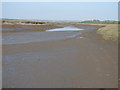
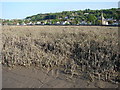
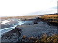
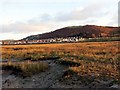
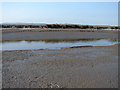
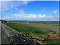
7 photos from this area
Area Information
Key information about the SA4 3RJ including its size, population, and administrative classification.
- Area Type
- Postcode
- Area Size
- 8.6 hectares
- Population
- 1922
- Population Density
- 583 people/km²
House Prices in SA4 3RJ
12
Properties
£156,579
Average Sold Price
£32,000
Lowest Price
£266,500
Highest Price
Showing 12 properties
| Address | Type | Beds | Baths | Last Sale Price | Last Sale Date | |
|---|---|---|---|---|---|---|
| Westville, The Promenade, Penclawdd, Swansea, SA4 3RJ | Detached | 3 | 1 | £92,551 | Mar 2016 | |
| Foamedge, The Promenade, Penclawdd, Swansea, SA4 3RJ | house | 3 | 1 | £170,000 | Jul 2015 | |
| Glandwr, The Promenade, Penclawdd, Swansea, SA4 3RJ | Semi-detached | - | - | £136,000 | Dec 2009 | |
| Sea Breeze, The Promenade, Penclawdd, Swansea, SA4 3RJ | Semi-detached | - | - | £249,000 | May 2008 | |
| Crud Yr Awel, The Promenade, Penclawdd, Swansea, SA4 3RJ | Bungalow | 2 | 1 | £150,000 | Jun 2006 | |
| Gwrid Y Gorwel, The Promenade, Penclawdd, Swansea, SA4 3RJ | Semi-detached | - | - | £266,500 | Jun 2004 | |
| Sea View, The Promenade, Penclawdd, Swansea, SA4 3RJ | Semi-detached | - | - | £32,000 | May 1995 | |
| Hillsborough, The Promenade, Penclawdd, Swansea, SA4 3RJ | Detached | 3 | 2 | - | - | |
| Trem Mor, The Promenade, Penclawdd, Swansea, SA4 3RJ | Semi-detached | - | - | - | - | |
| Troed Y Rhiw, The Promenade, Penclawdd, Swansea, SA4 3RJ | house | - | - | - | - |
Page 1 of 2
Energy Efficiency in SA4 3RJ
Amenities
Schools
| Rank | School | Type | Entry gender | Ages |
|---|
Explore more schools in this area
Go to Schools tabDemographics
Household Size
Two person
most common
Accommodation Type
Houses
most common
Tenure
74
majority
Ethnic Group
White
most common
Religion
N/A
most common
Household Composition
N/A
most common
Age
47
median
Adults (30-64 years)
most common
Household Deprivation
N/A
with no deprivation
NS-SEC
32
in Lower managerial occupations
Explore more demographic insights in this area
Go to Demographics tabPlanning
Planning Constraints
- Flood RiskPremium
- Ramsar Wetland SitesPremium
- Area of Outstanding Natural BeautyPremium
- Protected Nature ReservePremium
- Protected WoodlandPremium
- Crime RiskPremium