Area Overview for SA4 3RD
Photos of SA4 3RD
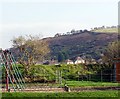
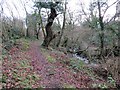
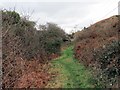
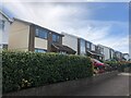
11 photos from this area
Area Information
Key information about the SA4 3RD including its size, population, and administrative classification.
- Area Type
- Postcode
- Area Size
- 10.8 hectares
- Population
- 1922
- Population Density
- 583 people/km²
House Prices in SA4 3RD
31
Properties
£218,353
Average Sold Price
£100,000
Lowest Price
£375,000
Highest Price
Showing 31 properties
| Address | Type | Beds | Baths | Last Sale Price | Last Sale Date | |
|---|---|---|---|---|---|---|
| 2 Waun Y Felin, Penclawdd, Swansea, SA4 3RD | Detached | 4 | 1 | £375,000 | Jan 2023 | |
| 1 Waun Y Felin, Penclawdd, Swansea, SA4 3RD | house | - | - | £335,000 | Jul 2021 | |
| 18 Waun Y Felin, Penclawdd, Swansea, SA4 3RD | Bungalow | 2 | 1 | £177,500 | Jun 2021 | |
| 26 Waun Y Felin, Penclawdd, Swansea, SA4 3RD | Bungalow | 3 | 2 | £193,000 | Apr 2019 | |
| 25 Waun Y Felin, Penclawdd, Swansea, SA4 3RD | Detached | 4 | 1 | £263,750 | Oct 2017 | |
| 22 Waun Y Felin, Penclawdd, Swansea, SA4 3RD | Bungalow | 2 | 1 | £207,500 | Nov 2016 | |
| 6 Waun Y Felin, Penclawdd, Swansea, SA4 3RD | Detached | 4 | 2 | £220,000 | Nov 2016 | |
| 36 Waun Y Felin, Penclawdd, Swansea, SA4 3RD | Detached | 4 | 1 | £214,000 | Sep 2015 | |
| 23 Waun Y Felin, Penclawdd, Swansea, SA4 3RD | Semi-detached | - | - | £230,000 | May 2009 | |
| 29 Waun Y Felin, Penclawdd, Swansea, SA4 3RD | Detached | - | - | £180,000 | Feb 2008 |
Page 1 of 4
Energy Efficiency in SA4 3RD
Amenities
Schools
| Rank | School | Type | Entry gender | Ages |
|---|
Explore more schools in this area
Go to Schools tabDemographics
Household Size
Two person
most common
Accommodation Type
Houses
most common
Tenure
74
majority
Ethnic Group
White
most common
Religion
N/A
most common
Household Composition
N/A
most common
Age
47
median
Adults (30-64 years)
most common
Household Deprivation
N/A
with no deprivation
NS-SEC
32
in Lower managerial occupations
Explore more demographic insights in this area
Go to Demographics tabPlanning
Planning Constraints
- Flood RiskPremium
- Ramsar Wetland SitesPremium
- Area of Outstanding Natural BeautyPremium
- Protected Nature ReservePremium
- Protected WoodlandPremium
- Crime RiskPremium