Area Overview for SA4 3RB
Photos of SA4 3RB
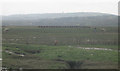
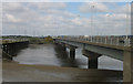

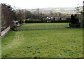
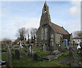
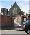
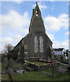
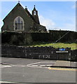
30 photos from this area
Area Information
Key information about the SA4 3RB including its size, population, and administrative classification.
- Area Type
- Postcode
- Area Size
- 2.8 km²
- Population
- 1462
- Population Density
- 246 people/km²
House Prices in SA4 3RB
11
Properties
£406,667
Average Sold Price
£215,000
Lowest Price
£750,000
Highest Price
Showing 11 properties
| Address | Type | Beds | Baths | Last Sale Price | Last Sale Date | |
|---|---|---|---|---|---|---|
| Plas-y-coed, Penclawdd Road, Penclawdd, Swansea, SA4 3RB | Bungalow | 5 | 6 | £750,000 | Dec 2023 | |
| Brandon Cottage, Penclawdd Road, Penclawdd, Swansea, SA4 3RB | Bungalow | 3 | 2 | £255,000 | Apr 2017 | |
| Halfway House, Penclawdd Road, Penclawdd, Swansea, SA4 3RB | Detached | - | - | £215,000 | Apr 2007 | |
| Savona, Penclawdd Road, Penclawdd, Swansea, SA4 3RB | Bungalow | 4 | 2 | - | - | |
| Caravan, Llwynmawr Farm, Penclawdd Road, Penclawdd, Swansea, SA4 3RB | Mobile Home | - | - | - | - | |
| Spring Mills House, Spring Mills, Penclawdd Road, Penclawdd, Swansea, SA4 3RB | house | - | - | - | - | |
| The Flat, The Rake And Riddle, Penclawdd Road, Penclawdd, Swansea, SA4 3RB | Flat | - | - | - | - | |
| Caravan, Spring Mills, Penclawdd Road, Penclawdd, Swansea, SA4 3RB | Mobile Home | - | - | - | - | |
| Brynymor Cottage, Penclawdd Road, Penclawdd, Swansea, SA4 3RB | Detached | - | - | - | - | |
| Llwynmawr Farm, Penclawdd Road, Penclawdd, Swansea, SA4 3RB | house | - | - | - | - |
Page 1 of 2
Energy Efficiency in SA4 3RB
Amenities
Schools
| Rank | School | Type | Entry gender | Ages |
|---|
Explore more schools in this area
Go to Schools tabDemographics
Household Size
Family (3-5 people)
most common
Accommodation Type
Houses
most common
Tenure
67
majority
Ethnic Group
White
most common
Religion
N/A
most common
Household Composition
N/A
most common
Age
47
median
Adults (30-64 years)
most common
Household Deprivation
N/A
with no deprivation
NS-SEC
33
in Lower managerial occupations
Explore more demographic insights in this area
Go to Demographics tabPlanning
Planning Constraints
- Flood RiskPremium
- Ramsar Wetland SitesPremium
- Area of Outstanding Natural BeautyPremium
- Protected Nature ReservePremium
- Protected WoodlandPremium
- Crime RiskPremium