Area Overview for SA4 3AZ
Photos of SA4 3AZ
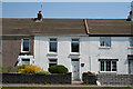
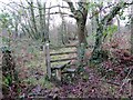
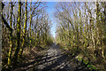
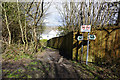
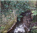
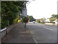
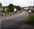
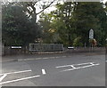
18 photos from this area
Area Information
Key information about the SA4 3AZ including its size, population, and administrative classification.
- Area Type
- Postcode
- Area Size
- 7587 m²
- Population
- 1703
- Population Density
- 1675 people/km²
House Prices in SA4 3AZ
22
Properties
£141,167
Average Sold Price
£52,500
Lowest Price
£229,000
Highest Price
Showing 22 properties
| Address | Type | Beds | Baths | Last Sale Price | Last Sale Date | |
|---|---|---|---|---|---|---|
| 22 Ravensfield, Gowerton, Swansea, SA4 3AZ | Semi-detached | 3 | 1 | £229,000 | Apr 2024 | |
| 19 Ravensfield, Gowerton, Swansea, SA4 3AZ | Semi-detached | 3 | - | £185,000 | Apr 2021 | |
| 15 Ravensfield, Gowerton, Swansea, SA4 3AZ | house | - | - | £160,000 | Mar 2021 | |
| 10 Ravensfield, Gowerton, Swansea, SA4 3AZ | house | - | - | £200,000 | Oct 2020 | |
| 14 Ravensfield, Gowerton, Swansea, SA4 3AZ | Semi-detached | 3 | 2 | £192,000 | Apr 2018 | |
| 8 Ravensfield, Gowerton, Swansea, SA4 3AZ | Semi-detached | 3 | 1 | £153,000 | Mar 2016 | |
| 1 Ravensfield, Gowerton, Swansea, SA4 3AZ | house | 3 | - | £140,000 | Nov 2014 | |
| 4 Ravensfield, Gowerton, Swansea, SA4 3AZ | Semi-detached | - | - | £144,000 | Apr 2006 | |
| 18 Ravensfield, Gowerton, Swansea, SA4 3AZ | house | 3 | - | £120,000 | Sep 2005 | |
| 20 Ravensfield, Gowerton, Swansea, SA4 3AZ | Semi-detached | 3 | 1 | £58,500 | Oct 1998 |
Page 1 of 3
Energy Efficiency in SA4 3AZ
Amenities
Schools
| Rank | School | Type | Entry gender | Ages |
|---|
Explore more schools in this area
Go to Schools tabDemographics
Household Size
Two person
most common
Accommodation Type
Houses
most common
Tenure
80
majority
Ethnic Group
White
most common
Religion
N/A
most common
Household Composition
N/A
most common
Age
47
median
Adults (30-64 years)
most common
Household Deprivation
N/A
with no deprivation
NS-SEC
37
in Lower managerial occupations
Explore more demographic insights in this area
Go to Demographics tabPlanning
Planning Constraints
- Flood RiskPremium
- Ramsar Wetland SitesPremium
- Area of Outstanding Natural BeautyPremium
- Protected Nature ReservePremium
- Protected WoodlandPremium
- Crime RiskPremium