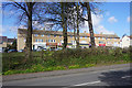
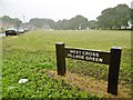
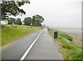
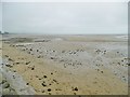
Area Overview for SA3 5NF
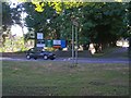
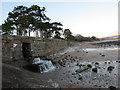
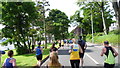
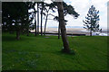
Photos of SA3 5NF


Area Information
Living in SA3 5NF offers a defined residential experience centred on a postcode cluster covering 3624 square metres. This small area accommodates a population of 1550 people, creating a concentrated community rather than a sprawling town. You will find yourself in a specific residential setting where property boundaries are close. The location sits within Wales, offering a quiet retreat characterised by its compact footprint. Daily life here revolves around the immediate surroundings, as the cluster size limits the distance to immediate neighbours. Residents enjoy a sense of proximity to one another within this small geographical footprint. The area functions as a self-contained residential hub where local interactions are frequent due to the density of the 1550 inhabitants.
- Area Type
- Postcode
- Area Size
- 3624 m²
- Population
- 1550
- Population Density
- 2720 people/km²
Homes in SA3 5NF are almost exclusively houses, as data shows houses as the primary accommodation type. This housing stock supports the very high home ownership rate of 86 per cent found within the area. You are unlikely to encounter modern rented developments or high-density flats here, as the market is defined by individual dwellings. The high ownership level suggests that most properties are owner-occupied homes rather than investment properties managed by landlords. If you are looking to buy homes in SA3 5NF, you will primarily be engaging with a market of existing homeowners. The concentration of houses indicates a traditional suburban or semi-rural property type rather than a regenerated urban block.
House Prices in SA3 5NF
Showing 3 properties
| Address | Type | Beds | Baths | Last Sale Price | Last Sale Date | |
|---|---|---|---|---|---|---|
| 3, Dolgoy Gardens, Westcross Lane, West Cross, Swansea, SA3 5NF | Semi-detached | - | - | £200,000 | Aug 1998 | |
| 2, Dolgoy Gardens, Westcross Lane, West Cross, Swansea, SA3 5NF | Semi-detached | - | - | - | - | |
| 1, Dolgoy Gardens, Westcross Lane, West Cross, Swansea, SA3 5NF | Detached | - | - | - | - |
Energy Efficiency in SA3 5NF
Living in SA3 5NF provides practical access to a variety of amenities within practical reach. Retail options are well represented with five venues available, including notable names such as Spar, Co-op West, and another Spar branch. Transport links are diverse, with two railway stations nearby including Swansea Railway Station and Gowerton Railway Station. Aviation access is convenient as Swansea Airport is located just two miles away, and the Swansea Queens Dock Ferry Terminal is just one mile distant. These facilities mean you have ready access to shops, train networks, air travel, and ferry connections without venturing far from your home.
Amenities
Schools
Families living in SA3 5NF have access to specific local educational facilities. Grange Primary School sits nearby and is categorised as a 'other' type school. St David's Catholic Primary School is located close to the area and also holds a 'other' classification. Additionally, the Primary Education Centre is situated within practical reach of the postcode cluster. You must note that the data for these institutions does not include specific Ofsted ratings or subject specialisms in the available records. The presence of three distinct primary or equivalent options ensures that young children in SA3 5NF have multiple local educational choices available without needing to travel far.
| Rank | School | Type | Entry gender | Ages |
|---|
Explore more schools in this area
Go to Schools tabDemographics
The community in SA3 5NF reflects a mature profile with a median age of 47 years. Most commonly, residents fall into the 30 to 64 year adult range. This age structure suggests a population that prioritises stability and established living over youthful development. Home ownership stands at a high 86 per cent, indicating that most households are settled and have purchased their local properties. The predominant accommodation type consists of houses, which aligns with the higher rate of owner occupation. You will find that the ethnic makeup is predominantly white, creating a relatively homogenous community. The high percentage of homeownership means the area caters strongly to those who have moved past the rental market and seek permanent homes.
Household Size
Accommodation Type
Tenure
Ethnic Group
Religion
Household Composition
Age
Household Deprivation
NS-SEC
Explore more demographic insights in this area
Go to Demographics tabPlanning
Planning Constraints
- Flood RiskPremium
- Ramsar Wetland SitesPremium
- Area of Outstanding Natural BeautyPremium
- Protected Nature ReservePremium
- Protected WoodlandPremium
- Crime RiskPremium