Area Overview for SA3 5EG
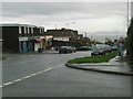
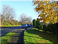
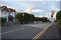
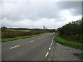
Photos of SA3 5EG

Area Information
Living in SA3 5EG offers a quiet residential experience within a defined cluster of homes. This specific postcode covers a small residential area measuring 2381 m². You are part of a community with a population of 1733 people. The density here is extremely high relative to the land size, recorded as 727891 people/km² by the dataset provided for this specific grid reference. This figure highlights a tightly packed neighbourhood rather than sprawling countryside. You move through an environment where any one of the 1733 residents could be a neighbour. The area functions as a distinct residential pocket within the wider Swansea region. Daily life centres around local access and community interaction. You do not find open parks or expansive green spaces within the immediate 2381 m² footprint. Instead, your daily routine involves reaching out to nearby towns for broader amenities. The location serves as a gateway to the coast and rail networks. You will find yourself well-positioned between Swansea city centre and rural villages. The compact nature of the estate means you can walk to nearby services quickly.
- Area Type
- Postcode
- Area Size
- 2381 m²
- Population
- 1733
- Population Density
- 2215 people/km²
The housing stock in SA3 5EG consists almost entirely of houses. You will not encounter flats or purpose-built apartments within this postcode cluster. Data confirms that Houses represent the predominant accommodation type. This aligns with the 56% home ownership rate recorded for the area. You are looking at a market defined by individual family properties rather than shared block living. Residents who purchase here seek a detached or semi-detached setting with private outdoor space. The high home ownership percentage suggests these homes are passed down or kept for generations. You are unlikely to find new-build conversions or modern leveraged buyouts. The market feels traditional and grounded. Buyers expecting a matrix of rental schemes or student housing will not find them here. If you intend to rent out property, you may struggle due to the lack of flats. Conversely, if you want to buy a family home to stay in, you have clear options. The character of the stock remains unchanged over time.
House Prices in SA3 5EG
Showing 6 properties
| Address | Type | Beds | Baths | Last Sale Price | Last Sale Date | |
|---|---|---|---|---|---|---|
| 2 Cherry Blossom Close, West Cross, Swansea, SA3 5EG | Bungalow | - | - | - | - | |
| 4 Cherry Blossom Close, West Cross, Swansea, SA3 5EG | Bungalow | - | - | - | - | |
| 5 Cherry Blossom Close, West Cross, Swansea, SA3 5EG | Bungalow | - | - | - | - | |
| 3 Cherry Blossom Close, West Cross, Swansea, SA3 5EG | Bungalow | - | - | - | - | |
| 6 Cherry Blossom Close, West Cross, Swansea, SA3 5EG | Bungalow | - | - | - | - | |
| 1 Cherry Blossom Close, West Cross, Swansea, SA3 5EG | Bungalow | - | - | - | - |
Energy Efficiency in SA3 5EG
Your lifestyle in SA3 5EG relies heavily on amenities just beyond the estate gates. You have immediate access to retail options from the two Spar stores and Co-op West. These supermarkets provide your weekly grocery needs without requiring a long drive. Convenience is a primary feature of your daily routine. Dining options are not listed in the immediate vicinity data, so you will likely use nearby town centres for restaurant visits. Leisure pursuits might include sailing or aviation, given the proximity to Swansea Airport listed as a neighbouring amenity. You are also close to the Swansea Railway Station and Gowerton Railway Station for cultural trips. The Swansea Queens Dock Ferry Terminal offers coastal escapes to Ireland and France. While the 2381 m² area lacks large parks, the transport links compensate by bringing the world to your doorstep. You can access public events, cinema, and sports facilities through the rail network. The retail presence of Co-op West and Spar anchors the local economic life.
Amenities
Schools
Families living in SA3 5EG rely on Mayals Primary School for their children's education. This is the only school listed in the immediate vicinity within the data provided. The school falls under the 'other' classification regarding type in the current records. No comprehensive school or secondary institution is explicitly named for this cluster in the available information. You will need to look beyond the immediate postcode for secondary education options. This limitation defines the family experience here. Mayals Primary School will be the main point of contact for primary-aged children. The distance to this specific school is a key factor in your daily commute. Parents must plan their logistics around the facilities available at Mayals Primary School. If you have older children, you will likely depend on feeder arrangements or travel to nearby towns. You cannot assume a full school catchment exists solely within this small residential cluster.
| Rank | School | Type | Entry gender | Ages |
|---|
Explore more schools in this area
Go to Schools tabDemographics
The community in SA3 5EG is predominantly made up of adults. Data shows the median age is 47 years. Most residents fall into the age range of 30 to 64 years. This indicates a settled population rather than a transient one. Homeownership is the norm, with 56% of households owning their property outright or with a mortgage. The remaining balance likely includes tenants or shared ownership arrangements. Houses form the primary accommodation type in this area. You will not find a concentration of flats or high-rise blocks here. The demographic profile is largely White, reflecting the historic fabric of the Swansea hinterland. These figures suggest you are joining a neighbourhood where families and mature couples have established deep roots. The high ownership rate implies stability and a long-term vision for the street. Neighbours likely know each other after years of living here. You will find less turnover than in student-heavy zones or major city centres. The age profile supports a family-oriented environment where children grow up in the same houses.
Household Size
Accommodation Type
Tenure
Ethnic Group
Religion
Household Composition
Age
Household Deprivation
NS-SEC
Explore more demographic insights in this area
Go to Demographics tabPlanning
Planning Constraints
- Flood RiskPremium
- Ramsar Wetland SitesPremium
- Area of Outstanding Natural BeautyPremium
- Protected Nature ReservePremium
- Protected WoodlandPremium
- Crime RiskPremium