Area Overview for SA3 4TY
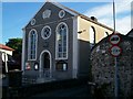
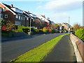
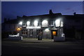
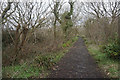
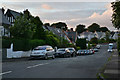
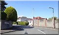
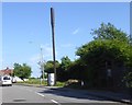
Photos of SA3 4TY


Area Information
Living in SA3 4TY means residing in a compact residential cluster defined by the postcode SA3 4TY. This specific area covers just three hectares, creating a tight-knit neighbourhood within the broader Swansea region of Wales. With a population of 1,679 people, the density reaches 55,948 people per square kilometre. Despite the small footprint, the location offers established living conditions typical of the townships surrounding Mumbles and Gowerton. Residents benefit from a mature environment where daily life revolves around proximity to local services and a quiet, settled atmosphere. The low total population indicates a stable community rather than a rapidly developing construction site. You find a setting that balances residential calm with access to wider transport networks without the noise of high-density city centres. This postcode represents a slice of semi-rural life just minutes from Swansea Airport and the coastal ferry terminal at Queens Dock.
- Area Type
- Postcode
- Area Size
- 3.0 hectares
- Population
- 1679
- Population Density
- 2268 people/km²
The property market in SA3 4TY is characterised by a strong leaning towards owner-occupation, with 90% of homes owned by their residents. Houses dominate the accommodation type landscape, making this postcode unsuitable for buyers specifically seeking city centre flats or apartments. This high ownership rate suggests a market driven by local families rather than transient investors or students. The primary housing stock consists of standard rural and suburban detached properties common to the Swansea hinterland. With only 1,679 residents spread across three hectares, the supply of properties remains limited compared to developments on the outskirts of Swansea city. You will find a market where prices reflect the quality of the local brick-built homes and the desirability of the quiet surroundings. Rental yields may be lower relative to purchase prices due to the scarcity of landlords in such a high ownership area. Buyers acting in SA3 4TY face a landscape where immediate resale values are supported by strong local community attachment.
House Prices in SA3 4TY
Showing 53 properties
| Address | Type | Beds | Baths | Last Sale Price | Last Sale Date | |
|---|---|---|---|---|---|---|
| 14 Highmead Avenue, Newton, Swansea, SA3 4TY | Detached | 3 | 2 | £330,000 | Nov 2025 | |
| 4 Highmead Avenue, Newton, Swansea, SA3 4TY | Bungalow | 3 | 1 | £375,000 | Feb 2025 | |
| 22 Highmead Avenue, Newton, Swansea, SA3 4TY | Semi-detached | 3 | 1 | £300,000 | Aug 2022 | |
| 31 Highmead Avenue, Newton, Swansea, SA3 4TY | house | 3 | 1 | £312,500 | Mar 2022 | |
| 55 Highmead Avenue, Newton, Swansea, SA3 4TY | Detached | 4 | 1 | £387,500 | Nov 2020 | |
| 28 Highmead Avenue, Newton, Swansea, SA3 4TY | Detached | 4 | 1 | £328,000 | Jan 2020 | |
| 18 Highmead Avenue, Newton, Swansea, SA3 4TY | Semi-detached | 3 | 1 | £216,500 | Sep 2019 | |
| 11 Highmead Avenue, Newton, Swansea, SA3 4TY | Bungalow | 2 | 2 | £285,000 | Apr 2019 | |
| 23 Highmead Avenue, Newton, Swansea, SA3 4TY | Bungalow | 4 | 2 | £325,000 | Jan 2018 | |
| 34 Highmead Avenue, Newton, Swansea, SA3 4TY | Detached | 4 | 2 | £324,000 | Jan 2018 |
Energy Efficiency in SA3 4TY
Residents of SA3 4TY enjoy practical access to retail, travel, and leisure facilities within a short drive. Five major retailers are located nearby, including Spar, M&S Mumbles, and Tesco Newton. These venues provide for weekly groceries, clothing, and household essentials without requiring travel deep into Swansea city centre. The area sits as a gateway to air travel and maritime links, with two airport terminals and one ferry terminal offering connections to London and across the Bristol Channel. You can fly out from Swansea Airport for business or leisure, or take the ferry from Swansea Queens Dock to explore the Welsh coast or South West England. The combination of Mumbles Manchester Store shops and transport hubs creates a lifestyle that blends rural quiet with metropolitan convenience. Dining and leisure options are found immediately at these retail locations, keeping daily errands efficient and close to home.
Amenities
Schools
Whitestone Primary School serves as the nearest educational institution to SA3 4TY. It is listed as a primary school within the immediate vicinity of the postcode. The data does not provide the specific Ofsted rating for Whitestone Primary School, so you cannot verify its current inspection status from the available records. As a primary school, it caters to students from early childhood through to upper primary years before they typically move to secondary education outside this immediate cluster. Since no secondary schools appear in the list of nearby facilities, families with older children must look beyond SA3 4TY for their first sixteen years of compulsory education. The presence of one primary school indicates a focus on early childhood education and after-school care for young families living in the garden suburbs of Mumbles. You must plan ahead regarding transport to secondary colleges if your children grow up in these homes.
| Rank | School | Type | Entry gender | Ages |
|---|
Explore more schools in this area
Go to Schools tabDemographics
The community in SA3 4TY is established, with a median age of 47 years indicating a mature population base. Most residents fall into the adult age range between 30 and 64 years, suggesting a focus on stability and family life. Home ownership stands at an impressive 90 percentage level, meaning the vast majority of households own their properties outright or with a mortgage. This contrasts sharply with typical rental markets found in larger urban centres of Wales. Houses form the primary accommodation type throughout the postcode, reflecting a preference for detached or semi-detached family structures over flats or apartments. The predominant ethnic group is White, aligning with the broader demographic profile of the Swansea and Carmarthenshire regions. The high home ownership rate often correlates with lower deprivation levels and longer-term community investment. You are joining an area where residents have likely put down significant roots over many years.
Household Size
Accommodation Type
Tenure
Ethnic Group
Religion
Household Composition
Age
Household Deprivation
NS-SEC
Explore more demographic insights in this area
Go to Demographics tabPlanning
Planning Constraints
- Flood RiskPremium
- Ramsar Wetland SitesPremium
- Area of Outstanding Natural BeautyPremium
- Protected Nature ReservePremium
- Protected WoodlandPremium
- Crime RiskPremium