Area Overview for SA3 4SU
Photos of SA3 4SU
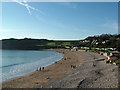
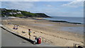
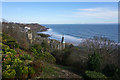
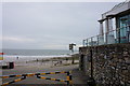
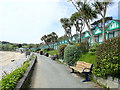
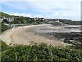
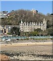
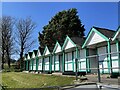
92 photos from this area
Area Information
Key information about the SA3 4SU including its size, population, and administrative classification.
- Area Type
- Postcode
- Area Size
- 1.3 hectares
- Population
- 1649
- Population Density
- 999 people/km²
House Prices in SA3 4SU
48
Properties
£230,833
Average Sold Price
£84,000
Lowest Price
£485,000
Highest Price
Showing 48 properties
| Address | Type | Beds | Baths | Last Sale Price | Last Sale Date | |
|---|---|---|---|---|---|---|
| 25 Nottage Road, Newton, Swansea, SA3 4SU | Detached | 4 | 1 | £485,000 | Aug 2025 | |
| 9 Nottage Road, Newton, Swansea, SA3 4SU | Terraced | 2 | 1 | £308,000 | Aug 2025 | |
| 24 Nottage Road, Newton, Swansea, SA3 4SU | Terraced | 2 | 1 | £270,000 | Jul 2025 | |
| 34 Nottage Road, Newton, Swansea, SA3 4SU | Detached | 3 | 2 | £250,000 | May 2025 | |
| 4 Nottage Road, Newton, Swansea, SA3 4SU | Semi-detached | 3 | 2 | £246,000 | Jan 2024 | |
| 29 Nottage Road, Newton, Swansea, SA3 4SU | Semi-detached | 3 | 1 | £350,000 | Aug 2023 | |
| 28 Nottage Road, Newton, Swansea, SA3 4SU | Terraced | 2 | 1 | £296,000 | Aug 2023 | |
| 20 Nottage Road, Newton, Swansea, SA3 4SU | Terraced | 3 | 1 | £257,500 | Apr 2023 | |
| 33 Nottage Road, Newton, Swansea, SA3 4SU | Semi-detached | 3 | 1 | £390,000 | Apr 2023 | |
| 5 Nottage Road, Newton, Swansea, SA3 4SU | Terraced | 3 | 1 | £300,000 | Nov 2022 |
Page 1 of 5
Energy Efficiency in SA3 4SU
Amenities
Schools
| Rank | School | Type | Entry gender | Ages |
|---|
Explore more schools in this area
Go to Schools tabDemographics
Household Size
One person
most common
Accommodation Type
Houses
most common
Tenure
76
majority
Ethnic Group
White
most common
Religion
N/A
most common
Household Composition
N/A
most common
Age
47
median
Adults (30-64 years)
most common
Household Deprivation
N/A
with no deprivation
NS-SEC
52
in Lower managerial occupations
Explore more demographic insights in this area
Go to Demographics tabPlanning
Planning Constraints
- Flood RiskPremium
- Ramsar Wetland SitesPremium
- Area of Outstanding Natural BeautyPremium
- Protected Nature ReservePremium
- Protected WoodlandPremium
- Crime RiskPremium