Area Overview for SA3 4PD
Photos of SA3 4PD

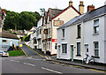
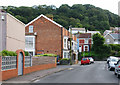
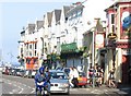

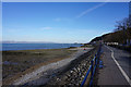
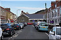
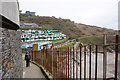
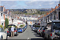
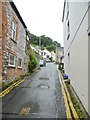
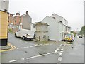
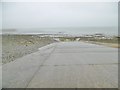
100 photos from this area
Area Information
Key information about the SA3 4PD including its size, population, and administrative classification.
- Area Type
- Postcode
- Area Size
- 3.1 hectares
- Population
- 1255
- Population Density
- 1002 people/km²
House Prices in SA3 4PD
26
Properties
£511,361
Average Sold Price
£115,000
Lowest Price
£1,150,000
Highest Price
Showing 26 properties
| Address | Type | Beds | Baths | Last Sale Price | Last Sale Date | |
|---|---|---|---|---|---|---|
| 75 Higher Lane, Langland, Swansea, SA3 4PD | Detached | 4 | 3 | £1,050,000 | Jun 2025 | |
| 67 Higher Lane, Langland, Swansea, SA3 4PD | Detached | 5 | - | £1,150,000 | Oct 2022 | |
| 68 Higher Lane, Langland, Swansea, SA3 4PD | house | - | - | £850,000 | Nov 2021 | |
| 77 Higher Lane, Langland, Swansea, SA3 4PD | Bungalow | - | - | £440,000 | Nov 2020 | |
| 65 Higher Lane, Langland, Swansea, SA3 4PD | Detached | 5 | 3 | £687,500 | Jul 2020 | |
| 85 Higher Lane, Langland, Swansea, SA3 4PD | Detached | 4 | 2 | £412,000 | Aug 2019 | |
| 72 Higher Lane, Langland, Swansea, SA3 4PD | Detached | 3 | 2 | £525,000 | Dec 2016 | |
| 71 Higher Lane, Langland, Swansea, SA3 4PD | Bungalow | 3 | 1 | £512,000 | Dec 2015 | |
| 56 Higher Lane, Langland, Swansea, SA3 4PD | house | 5 | - | £607,000 | Oct 2014 | |
| 66 Higher Lane, Langland, Swansea, SA3 4PD | Detached | 4 | - | £680,000 | Nov 2013 |
Page 1 of 3
Energy Efficiency in SA3 4PD
Amenities
Schools
| Rank | School | Type | Entry gender | Ages |
|---|
Explore more schools in this area
Go to Schools tabDemographics
Household Size
Two person
most common
Accommodation Type
Houses
most common
Tenure
85
majority
Ethnic Group
White
most common
Religion
N/A
most common
Household Composition
N/A
most common
Age
47
median
Adults (30-64 years)
most common
Household Deprivation
N/A
with no deprivation
NS-SEC
51
in Lower managerial occupations
Explore more demographic insights in this area
Go to Demographics tabPlanning
Planning Constraints
- Flood RiskPremium
- Ramsar Wetland SitesPremium
- Area of Outstanding Natural BeautyPremium
- Protected Nature ReservePremium
- Protected WoodlandPremium
- Crime RiskPremium