Area Overview for SA3 4JT
Photos of SA3 4JT
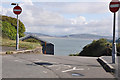
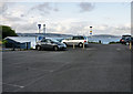
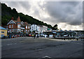
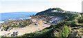
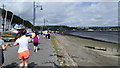

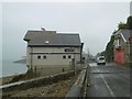
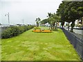
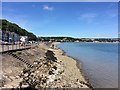
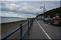
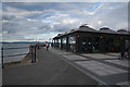
100 photos from this area
Area Information
Key information about the SA3 4JT including its size, population, and administrative classification.
- Area Type
- Postcode
- Area Size
- 6.3 hectares
- Population
- 1255
- Population Density
- 1002 people/km²
House Prices in SA3 4JT
4
Properties
-
Average Sold Price
-
Lowest Price
-
Highest Price
Showing 4 properties
| Address | Type | Beds | Baths | Last Sale Price | Last Sale Date | |
|---|---|---|---|---|---|---|
| Public Convenience Bracelet Bay, Access Road From Mumbles Road To Limeslade Car Park And Restaurant, Mumbles, Swansea, SA3 4JT | commercial | - | - | - | - | |
| Castellemare Recycling Site, Mumbles Road, Mumbles, Swansea, SA3 4JT | commercial | - | - | - | - | |
| Bracelet Bay Car Park Former Lifeguard Store, Access Road From Mumbles Road To Limeslade Car Park And Restaurant, Mumbles, Swansea, SA3 4JT | Farm | - | - | - | - | |
| The Lighthouse Brasserie, Mumbles Road, Mumbles, Swansea, SA3 4JT | restaurant_cafe | - | - | - | - |
Energy Efficiency in SA3 4JT
Amenities
Schools
| Rank | School | Type | Entry gender | Ages |
|---|
Explore more schools in this area
Go to Schools tabDemographics
Household Size
Two person
most common
Accommodation Type
Houses
most common
Tenure
85
majority
Ethnic Group
White
most common
Religion
N/A
most common
Household Composition
N/A
most common
Age
47
median
Adults (30-64 years)
most common
Household Deprivation
N/A
with no deprivation
NS-SEC
51
in Lower managerial occupations
Explore more demographic insights in this area
Go to Demographics tabPlanning
Planning Constraints
- Flood RiskPremium
- Ramsar Wetland SitesPremium
- Area of Outstanding Natural BeautyPremium
- Protected Nature ReservePremium
- Protected WoodlandPremium
- Crime RiskPremium