Area Overview for SA3 2AT
Photos of SA3 2AT
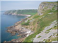
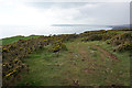
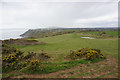
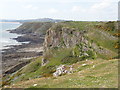
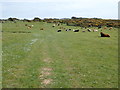
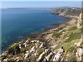
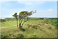
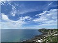
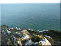
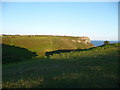
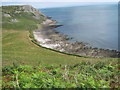
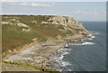
24 photos from this area
Area Information
Key information about the SA3 2AT including its size, population, and administrative classification.
- Area Type
- Postcode
- Area Size
- 98.0 hectares
- Population
- 1044
- Population Density
- 134 people/km²
House Prices in SA3 2AT
13
Properties
£711,750
Average Sold Price
£300,000
Lowest Price
£1,595,000
Highest Price
Showing 13 properties
| Address | Type | Beds | Baths | Last Sale Price | Last Sale Date | |
|---|---|---|---|---|---|---|
| HEDGEWAYS, UNCLASSIFIED SECTION Y 1629, Southgate, Swansea, SA3 2AT | Detached | - | - | £487,000 | Apr 2022 | |
| Kilsaran, Unclassified Section Y 1627, Southgate, Swansea, SA3 2AT | house | - | - | £1,595,000 | Dec 2021 | |
| Pwlldu Cottage, Unclassified Section Y 1629, Southgate, Swansea, SA3 2AT | house | - | - | £465,000 | Sep 2013 | |
| The Hayes, Unclassified Section Y 1628, Southgate, Swansea, SA3 2AT | Semi-detached | - | - | £300,000 | Jul 2008 | |
| Hunts Farm, East Cliff, Pennard, Swansea, SA3 2AT | house | 2 | - | - | - | |
| Honeysuckle Cottage, Unclassified Section Y 1629, Southgate, Swansea, SA3 2AT | Detached | - | - | - | - | |
| Caravan, Hedgeways, Unclassified Section Y 1629, Southgate, Swansea, SA3 2AT | Mobile Home | - | - | - | - | |
| Hunts Corner, Unclassified Section Y 1629, Southgate, Swansea, SA3 2AT | Semi-detached | - | - | - | - | |
| High Pennard Farm, Unclassified Section Y 1629, Southgate, Swansea, SA3 2AT | Detached | - | - | - | - | |
| Cliff Cottage, Unclassified Section Y 1626, Southgate, Swansea, SA3 2AT | Detached | - | - | - | - |
Page 1 of 2
Energy Efficiency in SA3 2AT
Amenities
Schools
| Rank | School | Type | Entry gender | Ages |
|---|
Explore more schools in this area
Go to Schools tabDemographics
Household Size
Two person
most common
Accommodation Type
Houses
most common
Tenure
87
majority
Ethnic Group
White
most common
Religion
N/A
most common
Household Composition
N/A
most common
Age
47
median
Adults (30-64 years)
most common
Household Deprivation
N/A
with no deprivation
NS-SEC
45
in Lower managerial occupations
Explore more demographic insights in this area
Go to Demographics tabPlanning
Planning Constraints
- Flood RiskPremium
- Ramsar Wetland SitesPremium
- Area of Outstanding Natural BeautyPremium
- Protected Nature ReservePremium
- Protected WoodlandPremium
- Crime RiskPremium