Area Overview for SA3 1LN
Photos of SA3 1LN
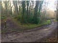


8 photos from this area
Area Information
Key information about the SA3 1LN including its size, population, and administrative classification.
- Area Type
- Postcode
- Area Size
- 4.1 km²
- Population
- 1626
- Population Density
- 31 people/km²
House Prices in SA3 1LN
10
Properties
£735,500
Average Sold Price
£551,000
Lowest Price
£920,000
Highest Price
Showing 10 properties
| Address | Type | Beds | Baths | Last Sale Price | Last Sale Date | |
|---|---|---|---|---|---|---|
| Sanctuary Farm, Unclassified Section Y 2145, Oxwich, Swansea, SA3 1LN | Detached | 5 | 5 | £920,000 | May 2022 | |
| Bysouth Farm, Unclassified Section Y 2144, Oxwich, Swansea, SA3 1LN | Detached | - | - | £551,000 | Aug 2006 | |
| Mill Wood Lodge, Unclassified Section Y 2145, Oxwich, Swansea, SA3 1LN | Detached | 5 | 5 | - | - | |
| Cliffs View, Unclassified Section Y 2119, Oxwich, Swansea, SA3 1LN | Detached | 6 | - | - | - | |
| Seaview, Unclassified Section Y 2115, Oxwich, Swansea, SA3 1LN | Detached | - | - | - | - | |
| Penrice Castle, Unclassified Section Y 2099, Oxwich, Swansea, SA3 1LN | Detached | - | - | - | - | |
| Merrysun, Unclassified Section Y 2145, Oxwich, Swansea, SA3 1LN | Detached | - | - | - | - | |
| Poundclose, Unclassified Section Y 2119, Oxwich, Swansea, SA3 1LN | house | - | - | - | - | |
| Rose Cottage, Unclassified Section Y 2117, Oxwich, Swansea, SA3 1LN | hotel | - | - | - | - | |
| Laundry House, A 4118 From Junction With Classified Section B 4247 To Junction With Classified Section C 168, Reynoldston, Swansea, SA3 1LN | Terraced | - | - | - | - |
Energy Efficiency in SA3 1LN
Amenities
Schools
| Rank | School | Type | Entry gender | Ages |
|---|
Explore more schools in this area
Go to Schools tabDemographics
Household Size
Two person
most common
Accommodation Type
Houses
most common
Tenure
82
majority
Ethnic Group
White
most common
Religion
N/A
most common
Household Composition
N/A
most common
Age
47
median
Adults (30-64 years)
most common
Household Deprivation
N/A
with no deprivation
NS-SEC
40
in Lower managerial occupations
Explore more demographic insights in this area
Go to Demographics tabPlanning
Planning Constraints
- Flood RiskPremium
- Ramsar Wetland SitesPremium
- Area of Outstanding Natural BeautyPremium
- Protected Nature ReservePremium
- Protected WoodlandPremium
- Crime RiskPremium