Area Overview for SA2 8HS
Photos of SA2 8HS
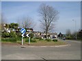
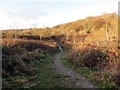
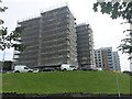
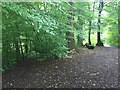
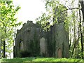
8 photos from this area
Area Information
Key information about the SA2 8HS including its size, population, and administrative classification.
- Area Type
- Postcode
- Area Size
- 1.4 hectares
- Population
- 1740
- Population Density
- 3637 people/km²
House Prices in SA2 8HS
43
Properties
£130,534
Average Sold Price
£52,500
Lowest Price
£190,000
Highest Price
Showing 43 properties
| Address | Type | Beds | Baths | Last Sale Price | Last Sale Date | |
|---|---|---|---|---|---|---|
| 94 Heather Crescent, Sketty, Swansea, SA2 8HS | house | 2 | 1 | £180,000 | Jun 2025 | |
| 77 Heather Crescent, Sketty, Swansea, SA2 8HS | Semi-detached | 3 | 1 | £185,000 | Dec 2024 | |
| 86 Heather Crescent, Sketty, Swansea, SA2 8HS | Terraced | 3 | 1 | £180,000 | Dec 2024 | |
| 78 Heather Crescent, Sketty, Swansea, SA2 8HS | Terraced | 3 | 1 | £180,000 | Apr 2023 | |
| 76 Heather Crescent, Sketty, Swansea, SA2 8HS | Terraced | 3 | 1 | £190,000 | Aug 2022 | |
| 66 Heather Crescent, Sketty, Swansea, SA2 8HS | house | 3 | 1 | £160,000 | Jun 2022 | |
| 60 Heather Crescent, Sketty, Swansea, SA2 8HS | Terraced | 2 | 1 | £137,000 | Jun 2021 | |
| 72 Heather Crescent, Sketty, Swansea, SA2 8HS | Semi-detached | 2 | 1 | £125,000 | Nov 2020 | |
| 88 Heather Crescent, Sketty, Swansea, SA2 8HS | Terraced | 3 | 1 | £129,950 | Mar 2020 | |
| 90 Heather Crescent, Sketty, Swansea, SA2 8HS | Terraced | 3 | 1 | £131,000 | Jul 2019 |
Page 1 of 5
Energy Efficiency in SA2 8HS
Amenities
Schools
| Rank | School | Type | Entry gender | Ages |
|---|
Explore more schools in this area
Go to Schools tabDemographics
Household Size
One person
most common
Accommodation Type
Flats
most common
Tenure
33
majority
Ethnic Group
White
most common
Religion
N/A
most common
Household Composition
N/A
most common
Age
47
median
Adults (30-64 years)
most common
Household Deprivation
N/A
with no deprivation
NS-SEC
24
in Lower managerial occupations
Explore more demographic insights in this area
Go to Demographics tabPlanning
Planning Constraints
- Flood RiskPremium
- Ramsar Wetland SitesPremium
- Area of Outstanding Natural BeautyPremium
- Protected Nature ReservePremium
- Protected WoodlandPremium
- Crime RiskPremium