Area Overview for SA2 7PW
Photos of SA2 7PW
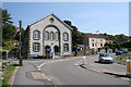
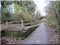
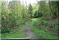
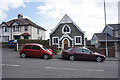
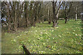
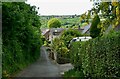
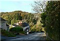
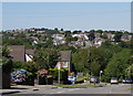
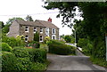
34 photos from this area
Area Information
Key information about the SA2 7PW including its size, population, and administrative classification.
- Area Type
- Postcode
- Area Size
- 7738 m²
- Population
- 1525
- Population Density
- 4029 people/km²
House Prices in SA2 7PW
25
Properties
£137,538
Average Sold Price
£49,750
Lowest Price
£249,950
Highest Price
Showing 25 properties
| Address | Type | Beds | Baths | Last Sale Price | Last Sale Date | |
|---|---|---|---|---|---|---|
| 26 Rhiwlas, Dunvant, Swansea, SA2 7PW | Semi-detached | 3 | 1 | £249,950 | Feb 2025 | |
| 19 Rhiwlas, Dunvant, Swansea, SA2 7PW | Semi-detached | 3 | 1 | £207,000 | Jan 2024 | |
| 21 Rhiwlas, Dunvant, Swansea, SA2 7PW | Semi-detached | 3 | 1 | £200,000 | Mar 2023 | |
| 23 Rhiwlas, Dunvant, Swansea, SA2 7PW | Semi-detached | 2 | 1 | £167,000 | Mar 2021 | |
| 9 Rhiwlas, Dunvant, Swansea, SA2 7PW | Semi-detached | 3 | 1 | £159,500 | Feb 2019 | |
| 2 Rhiwlas, Dunvant, Swansea, SA2 7PW | Semi-detached | 3 | 1 | £155,000 | Jan 2018 | |
| 15 Rhiwlas, Dunvant, Swansea, SA2 7PW | house | - | - | £151,000 | Apr 2014 | |
| 12 Rhiwlas, Dunvant, Swansea, SA2 7PW | Semi-detached | - | - | £147,500 | Aug 2006 | |
| 18 Rhiwlas, Dunvant, Swansea, SA2 7PW | Terraced | - | - | £52,000 | Mar 2000 | |
| 10 Rhiwlas, Dunvant, Swansea, SA2 7PW | Semi-detached | - | - | £54,750 | Nov 1997 |
Page 1 of 3
Energy Efficiency in SA2 7PW
Amenities
Schools
| Rank | School | Type | Entry gender | Ages |
|---|
Explore more schools in this area
Go to Schools tabDemographics
Household Size
Two person
most common
Accommodation Type
Houses
most common
Tenure
88
majority
Ethnic Group
White
most common
Religion
N/A
most common
Household Composition
N/A
most common
Age
47
median
Adults (30-64 years)
most common
Household Deprivation
N/A
with no deprivation
NS-SEC
37
in Lower managerial occupations
Explore more demographic insights in this area
Go to Demographics tabPlanning
Planning Constraints
- Flood RiskPremium
- Ramsar Wetland SitesPremium
- Area of Outstanding Natural BeautyPremium
- Protected Nature ReservePremium
- Protected WoodlandPremium
- Crime RiskPremium