Area Overview for SA2 7NZ
Photos of SA2 7NZ
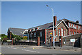
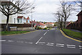
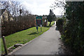
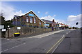

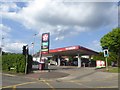
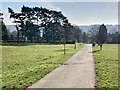
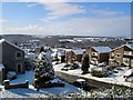
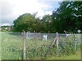
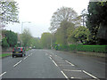
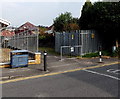
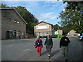
17 photos from this area
Area Information
Key information about the SA2 7NZ including its size, population, and administrative classification.
- Area Type
- Postcode
- Area Size
- 6029 m²
- Population
- 1525
- Population Density
- 4029 people/km²
House Prices in SA2 7NZ
22
Properties
£104,000
Average Sold Price
£30,000
Lowest Price
£240,000
Highest Price
Showing 22 properties
| Address | Type | Beds | Baths | Last Sale Price | Last Sale Date | |
|---|---|---|---|---|---|---|
| 28 Wellfield, Dunvant, Swansea, SA2 7NZ | Terraced | 3 | 1 | £240,000 | Feb 2025 | |
| 21 Wellfield, Dunvant, Swansea, SA2 7NZ | Semi-detached | 3 | 1 | £125,000 | Aug 2018 | |
| 14 Wellfield, Dunvant, Swansea, SA2 7NZ | house | - | - | £127,500 | Apr 2010 | |
| 24 Wellfield, Dunvant, Swansea, SA2 7NZ | Terraced | 3 | 1 | £141,000 | Dec 2007 | |
| 12 Wellfield, Dunvant, Swansea, SA2 7NZ | house | - | - | £122,500 | May 2007 | |
| 9 Wellfield, Dunvant, Swansea, SA2 7NZ | Semi-detached | 3 | 1 | £143,000 | Jul 2006 | |
| 3 Wellfield, Dunvant, Swansea, SA2 7NZ | Semi-detached | - | - | £149,500 | Aug 2004 | |
| 18 Wellfield, Dunvant, Swansea, SA2 7NZ | house | - | - | £30,000 | Jan 2004 | |
| 26 Wellfield, Dunvant, Swansea, SA2 7NZ | Terraced | 3 | 1 | £87,500 | May 2003 | |
| 15 Wellfield, Dunvant, Swansea, SA2 7NZ | Semi-detached | - | - | £82,000 | Jan 2003 |
Page 1 of 3
Energy Efficiency in SA2 7NZ
Amenities
Schools
| Rank | School | Type | Entry gender | Ages |
|---|
Explore more schools in this area
Go to Schools tabDemographics
Household Size
Two person
most common
Accommodation Type
Houses
most common
Tenure
88
majority
Ethnic Group
White
most common
Religion
N/A
most common
Household Composition
N/A
most common
Age
47
median
Adults (30-64 years)
most common
Household Deprivation
N/A
with no deprivation
NS-SEC
37
in Lower managerial occupations
Explore more demographic insights in this area
Go to Demographics tabPlanning
Planning Constraints
- Flood RiskPremium
- Ramsar Wetland SitesPremium
- Area of Outstanding Natural BeautyPremium
- Protected Nature ReservePremium
- Protected WoodlandPremium
- Crime RiskPremium