Area Overview for SA2 0JA
Photos of SA2 0JA
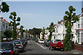

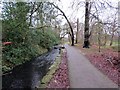
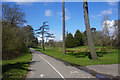
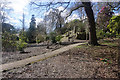

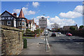
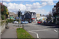
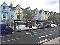
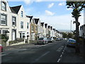
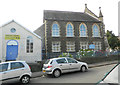
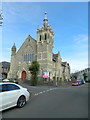
77 photos from this area
Area Information
Key information about the SA2 0JA including its size, population, and administrative classification.
- Area Type
- Postcode
- Area Size
- 4331 m²
- Population
- 1791
- Population Density
- 7855 people/km²
House Prices in SA2 0JA
18
Properties
£170,325
Average Sold Price
£79,950
Lowest Price
£270,000
Highest Price
Showing 18 properties
| Address | Type | Beds | Baths | Last Sale Price | Last Sale Date | |
|---|---|---|---|---|---|---|
| 23 Pantygwydr Road, Uplands, Swansea, SA2 0JA | Terraced | 4 | 1 | £237,000 | Nov 2024 | |
| 29 Pantygwydr Road, Uplands, Swansea, SA2 0JA | Terraced | 3 | 2 | £270,000 | Oct 2023 | |
| 28 Pantygwydr Road, Uplands, Swansea, SA2 0JA | Terraced | 3 | - | £181,000 | Oct 2016 | |
| 19 Pantygwydr Road, Uplands, Swansea, SA2 0JA | Terraced | 4 | 2 | £210,000 | Feb 2016 | |
| 16 Pantygwydr Road, Uplands, Swansea, SA2 0JA | Terraced | 5 | 1 | £140,000 | Dec 2012 | |
| 33 Pantygwydr Road, Uplands, Swansea, SA2 0JA | house | 6 | 2 | £138,000 | Jan 2011 | |
| 24 Pantygwydr Road, Uplands, Swansea, SA2 0JA | house | - | - | £195,000 | Jan 2010 | |
| 27 Pantygwydr Road, Uplands, Swansea, SA2 0JA | house | 4 | 2 | £195,000 | Jun 2008 | |
| 18 Pantygwydr Road, Uplands, Swansea, SA2 0JA | Terraced | 5 | 1 | £205,000 | Jan 2007 | |
| 25 Pantygwydr Road, Uplands, Swansea, SA2 0JA | Detached | 5 | 2 | £182,950 | Jun 2006 |
Page 1 of 2
Energy Efficiency in SA2 0JA
Amenities
Schools
| Rank | School | Type | Entry gender | Ages |
|---|
Explore more schools in this area
Go to Schools tabDemographics
Household Size
Family (3-5 people)
most common
Accommodation Type
Houses
most common
Tenure
47
majority
Ethnic Group
White
most common
Religion
N/A
most common
Household Composition
N/A
most common
Age
22
median
Young Adults (15-29 years)
most common
Household Deprivation
N/A
with no deprivation
NS-SEC
22
in Lower managerial occupations
Explore more demographic insights in this area
Go to Demographics tabPlanning
Planning Constraints
- Flood RiskPremium
- Ramsar Wetland SitesPremium
- Area of Outstanding Natural BeautyPremium
- Protected Nature ReservePremium
- Protected WoodlandPremium
- Crime RiskPremium