Area Overview for SA1 8LA
Photos of SA1 8LA
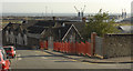
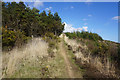
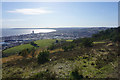
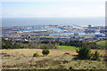
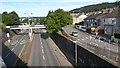
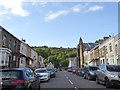
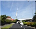
74 photos from this area
Area Information
Key information about the SA1 8LA including its size, population, and administrative classification.
- Area Type
- Postcode
- Area Size
- 7937 m²
- Population
- 1459
- Population Density
- 4448 people/km²
House Prices in SA1 8LA
42
Properties
£77,710
Average Sold Price
£23,000
Lowest Price
£150,000
Highest Price
Showing 42 properties
| Address | Type | Beds | Baths | Last Sale Price | Last Sale Date | |
|---|---|---|---|---|---|---|
| 3 Jersey Terrace, Port Tennant, Swansea, SA1 8LA | Terraced | 3 | 1 | £150,000 | Sep 2023 | |
| 30 Jersey Terrace, Port Tennant, Swansea, SA1 8LA | Terraced | 3 | 1 | £149,000 | Jun 2022 | |
| 19 Jersey Terrace, Port Tennant, Swansea, SA1 8LA | Terraced | - | - | £140,000 | May 2019 | |
| 23 Jersey Terrace, Port Tennant, Swansea, SA1 8LA | Terraced | 3 | 1 | £98,000 | Jun 2018 | |
| 24 Jersey Terrace, Port Tennant, Swansea, SA1 8LA | Terraced | 3 | 1 | £105,000 | Apr 2017 | |
| 33 Jersey Terrace, Port Tennant, Swansea, SA1 8LA | Terraced | 3 | 1 | £110,000 | Oct 2016 | |
| 35 Jersey Terrace, Port Tennant, Swansea, SA1 8LA | house | 3 | 1 | £87,520 | Feb 2015 | |
| 39 Jersey Terrace, Port Tennant, Swansea, SA1 8LA | Terraced | 5 | 1 | £74,000 | Mar 2014 | |
| 16 Jersey Terrace, Port Tennant, Swansea, SA1 8LA | house | - | - | £60,000 | Mar 2014 | |
| 37 Jersey Terrace, Port Tennant, Swansea, SA1 8LA | house | - | - | £93,000 | Feb 2013 |
Page 1 of 5
Energy Efficiency in SA1 8LA
Amenities
Schools
| Rank | School | Type | Entry gender | Ages |
|---|
Explore more schools in this area
Go to Schools tabDemographics
Household Size
Family (3-5 people)
most common
Accommodation Type
Houses
most common
Tenure
67
majority
Ethnic Group
White
most common
Religion
N/A
most common
Household Composition
N/A
most common
Age
47
median
Adults (30-64 years)
most common
Household Deprivation
N/A
with no deprivation
NS-SEC
18
in Lower managerial occupations
Explore more demographic insights in this area
Go to Demographics tabPlanning
Planning Constraints
- Flood RiskPremium
- Ramsar Wetland SitesPremium
- Area of Outstanding Natural BeautyPremium
- Protected Nature ReservePremium
- Protected WoodlandPremium
- Crime RiskPremium