Area Overview for SA1 8JU
Photos of SA1 8JU
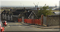
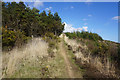
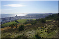
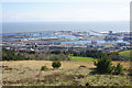
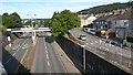
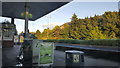
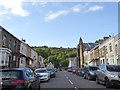
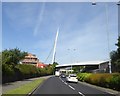
74 photos from this area
Area Information
Key information about the SA1 8JU including its size, population, and administrative classification.
- Area Type
- Postcode
- Area Size
- 3.1 hectares
- Population
- 1407
- Population Density
- 1007 people/km²
House Prices in SA1 8JU
50
Properties
£82,300
Average Sold Price
£18,000
Lowest Price
£165,000
Highest Price
Showing 50 properties
| Address | Type | Beds | Baths | Last Sale Price | Last Sale Date | |
|---|---|---|---|---|---|---|
| 167 Port Tennant Road, Port Tennant, Swansea, SA1 8JU | Terraced | 3 | 2 | £165,000 | Aug 2023 | |
| 171 Port Tennant Road, Port Tennant, Swansea, SA1 8JU | house | 3 | 1 | £137,000 | Jan 2022 | |
| 227 Port Tennant Road, Port Tennant, Swansea, SA1 8JU | Terraced | 2 | 2 | £118,500 | Jan 2020 | |
| 165 Port Tennant Road, Port Tennant, Swansea, SA1 8JU | Terraced | 3 | 1 | £117,000 | Sep 2018 | |
| 169 Port Tennant Road, Port Tennant, Swansea, SA1 8JU | house | - | - | £110,000 | Nov 2011 | |
| 237 Port Tennant Road, Port Tennant, Swansea, SA1 8JU | house | 3 | - | £30,000 | Apr 2009 | |
| 216 Port Tennant Road, Port Tennant, Swansea, SA1 8JU | Terraced | 4 | 1 | £125,000 | Apr 2004 | |
| 224 Port Tennant Road, Port Tennant, Swansea, SA1 8JU | Terraced | 3 | 1 | £125,000 | Apr 2004 | |
| 235 Port Tennant Road, Port Tennant, Swansea, SA1 8JU | Terraced | - | - | £21,000 | Jan 2001 | |
| 191 Port Tennant Road, Port Tennant, Swansea, SA1 8JU | Terraced | - | - | £35,500 | Jun 1998 |
Page 1 of 5
Energy Efficiency in SA1 8JU
Amenities
Schools
| Rank | School | Type | Entry gender | Ages |
|---|
Explore more schools in this area
Go to Schools tabDemographics
Household Size
One person
most common
Accommodation Type
Flats
most common
Tenure
42
majority
Ethnic Group
White
most common
Religion
N/A
most common
Household Composition
N/A
most common
Age
47
median
Adults (30-64 years)
most common
Household Deprivation
N/A
with no deprivation
NS-SEC
30
in Lower managerial occupations
Explore more demographic insights in this area
Go to Demographics tabPlanning
Planning Constraints
- Flood RiskPremium
- Ramsar Wetland SitesPremium
- Area of Outstanding Natural BeautyPremium
- Protected Nature ReservePremium
- Protected WoodlandPremium
- Crime RiskPremium