Area Overview for SA1 7HH
Photos of SA1 7HH
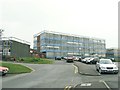
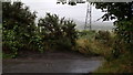
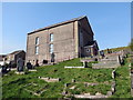
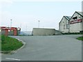
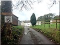
8 photos from this area
Area Information
Key information about the SA1 7HH including its size, population, and administrative classification.
- Area Type
- Postcode
- Area Size
- 8.4 hectares
- Population
- 1875
- Population Density
- 919 people/km²
House Prices in SA1 7HH
49
Properties
£83,035
Average Sold Price
£12,500
Lowest Price
£170,000
Highest Price
Showing 49 properties
| Address | Type | Beds | Baths | Last Sale Price | Last Sale Date | |
|---|---|---|---|---|---|---|
| 43 Cefn Road, Bonymaen, Swansea, SA1 7HH | Semi-detached | 3 | 1 | £157,000 | Oct 2024 | |
| 27 Cefn Road, Bonymaen, Swansea, SA1 7HH | Semi-detached | 2 | 1 | £125,000 | Sep 2024 | |
| 44 Cefn Road, Bonymaen, Swansea, SA1 7HH | Semi-detached | 2 | 1 | £110,000 | Jan 2024 | |
| 16 Cefn Road, Bonymaen, Swansea, SA1 7HH | Terraced | 2 | 1 | £143,500 | Sep 2023 | |
| 34 Cefn Road, Bonymaen, Swansea, SA1 7HH | Retail | 5 | 1 | £98,000 | Apr 2023 | |
| 29 Cefn Road, Bonymaen, Swansea, SA1 7HH | Semi-detached | 2 | 1 | £90,000 | Aug 2022 | |
| 71 Cefn Road, Bonymaen, Swansea, SA1 7HH | Retail | 3 | 2 | £115,000 | Mar 2022 | |
| 41 Cefn Road, Bonymaen, Swansea, SA1 7HH | Semi-detached | - | - | £144,000 | Jun 2021 | |
| 56 Cefn Road, Bonymaen, Swansea, SA1 7HH | house | 2 | - | £64,000 | Dec 2020 | |
| 25 Cefn Road, Bonymaen, Swansea, SA1 7HH | Semi-detached | 2 | 1 | £85,000 | Sep 2020 |
Page 1 of 5
Energy Efficiency in SA1 7HH
Amenities
Schools
| Rank | School | Type | Entry gender | Ages |
|---|
Explore more schools in this area
Go to Schools tabDemographics
Household Size
Two person
most common
Accommodation Type
Houses
most common
Tenure
57
majority
Ethnic Group
White
most common
Religion
N/A
most common
Household Composition
N/A
most common
Age
47
median
Adults (30-64 years)
most common
Household Deprivation
N/A
with no deprivation
NS-SEC
21
in Lower managerial occupations
Explore more demographic insights in this area
Go to Demographics tabPlanning
Planning Constraints
- Flood RiskPremium
- Ramsar Wetland SitesPremium
- Area of Outstanding Natural BeautyPremium
- Protected Nature ReservePremium
- Protected WoodlandPremium
- Crime RiskPremium