Area Overview for SA1 7EX
Photos of SA1 7EX


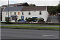
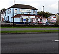
85 photos from this area
Area Information
Key information about the SA1 7EX including its size, population, and administrative classification.
- Area Type
- Postcode
- Area Size
- 2.6 hectares
- Population
- 1875
- Population Density
- 919 people/km²
House Prices in SA1 7EX
43
Properties
£154,433
Average Sold Price
£129,000
Lowest Price
£218,000
Highest Price
Showing 43 properties
| Address | Type | Beds | Baths | Last Sale Price | Last Sale Date | |
|---|---|---|---|---|---|---|
| 46 Morris Drive, Pentrechwyth, Swansea, SA1 7EX | Semi-detached | 2 | 1 | £203,000 | Feb 2025 | |
| 60 Morris Drive, Pentrechwyth, Swansea, SA1 7EX | Semi-detached | 3 | 1 | £218,000 | Dec 2024 | |
| 64 Morris Drive, Pentrechwyth, Swansea, SA1 7EX | Semi-detached | 2 | 1 | £185,000 | Jan 2023 | |
| 70 Morris Drive, Pentrechwyth, Swansea, SA1 7EX | Retail | 2 | 1 | £191,500 | Oct 2022 | |
| 74 Morris Drive, Pentrechwyth, Swansea, SA1 7EX | Terraced | 2 | 2 | £141,000 | Apr 2018 | |
| 72 Morris Drive, Pentrechwyth, Swansea, SA1 7EX | Terraced | 2 | 1 | £141,000 | Apr 2018 | |
| 50 Morris Drive, Pentrechwyth, Swansea, SA1 7EX | house | - | - | £133,000 | Mar 2017 | |
| 66 Morris Drive, Pentrechwyth, Swansea, SA1 7EX | Terraced | 2 | 1 | £129,000 | Mar 2017 | |
| 48 Morris Drive, Pentrechwyth, Swansea, SA1 7EX | Semi-detached | 2 | 1 | £138,000 | Mar 2017 | |
| 56 Morris Drive, Pentrechwyth, Swansea, SA1 7EX | house | - | - | £137,000 | Feb 2017 |
Page 1 of 5
Energy Efficiency in SA1 7EX
Amenities
Schools
| Rank | School | Type | Entry gender | Ages |
|---|
Explore more schools in this area
Go to Schools tabDemographics
Household Size
Two person
most common
Accommodation Type
Houses
most common
Tenure
57
majority
Ethnic Group
White
most common
Religion
N/A
most common
Household Composition
N/A
most common
Age
47
median
Adults (30-64 years)
most common
Household Deprivation
N/A
with no deprivation
NS-SEC
21
in Lower managerial occupations
Explore more demographic insights in this area
Go to Demographics tabPlanning
Planning Constraints
- Flood RiskPremium
- Ramsar Wetland SitesPremium
- Area of Outstanding Natural BeautyPremium
- Protected Nature ReservePremium
- Protected WoodlandPremium
- Crime RiskPremium