Area Overview for SA1 7BG
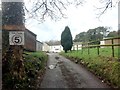
Photos of SA1 7BG
Area Information
Living in SA1 7BG offers a grounded residential experience within a defined cluster measuring 28.6 hectares. You will find this postcode situated in Wales, providing a manageable scale for those seeking a specific neighbourhood feel. With a population of 1,762, the community maintains a compact size that avoids the sprawl often found in larger urban zones. This demographic density translates to a moderate population density of 366 people per square kilometre, ensuring the area remains residential rather than industrial or commercial. The streets here form a cluster where daily interactions are regular but not overwhelming, creating a distinct living environment separate from the wider Swansea landscape. Prospective buyers often look beyond surface-level descriptions to understand the true character of a postcode. SA1 7BG represents a small residential unit where the focus is on immediate surroundings and practicality. The area does not boast vast open spaces in the traditional sense, given its limited total area. Instead, the charm lies in its specific location and the stability it offers to residents who value a clear, bounded home environment. Those considering homes in this specific cluster should appreciate the tight-knit nature of a community this size. It is an area where the boundaries are clear, and the scope of daily life is defined by proximity to local services rather than long commutes.
- Area Type
- Postcode
- Area Size
- 28.6 hectares
- Population
- 1762
- Population Density
- 366 people/km²
The property market in SA1 7BG is defined by a specific mix of accommodation types and ownership structures. Houses make up the vast majority of homes in this postcode, catering to those who prefer detached or semi-detached living over flats or apartments. This housing preference mirrors the demographic reality, where families and long-term adults seek the space that houses provide. With a home ownership rate of 41%, the market includes a notable proportion of owner-occupied properties, though slightly less than half of the homes are rented. For buyers looking at this small area, the dominance of houses means that traditional bungalow or multi-bedroom options are more likely than high-density apartment blocks. The 41% ownership figure indicates a balanced market where available purchase opportunities exist alongside rental vacancies. You might find a range of older properties given the mature age of the residents, which often correlates with established architectural styles. The limited total area of 28.6 hectares constraints the number of new builds, meaning the available stock has been there for some time. This stability can be an attraction, as property values in such specific clusters often reflect consistent demand from those seeking suburban feel within a constrained zone. Whether you are looking to buy or rent, the focus here is on traditional residential houses rather than modern urban developments.
House Prices in SA1 7BG
Showing 10 properties
| Address | Type | Beds | Baths | Last Sale Price | Last Sale Date | |
|---|---|---|---|---|---|---|
| 2 Pantygyfelia Farm, 0 Tydraw Road, Bonymaen, Swansea, SA1 7BG | Semi-detached | 5 | 2 | £95,000 | Apr 1998 | |
| Caravan, Cwm Dial Farm, Ty Draw Road, Bonymaen, Swansea, SA1 7BG | Mobile Home | - | - | - | - | |
| Bog Cottage, Ty Draw Road, Bonymaen, Swansea, SA1 7BG | Semi-detached | - | - | - | - | |
| September, Cwm Dial Farm, Ty Draw Road, Bonymaen, Swansea, SA1 7BG | Semi-detached | - | - | - | - | |
| Russet Dale House, Ty Draw Road, Bonymaen, Swansea, SA1 7BG | Detached | - | - | - | - | |
| 1, Pantygyfeila Farm, Ty Draw Road, Bonymaen, Swansea, SA1 7BG | Semi-detached | - | - | - | - | |
| 1, Pantygyfeila Villas, Ty Draw Road, Bonymaen, Swansea, SA1 7BG | Semi-detached | - | - | - | - | |
| Norwood House, Ty Draw Road, Bonymaen, Swansea, SA1 7BG | Detached | - | - | - | - | |
| Cwm Dial Farm, Ty Draw Road, Bonymaen, Swansea, SA1 7BG | Bungalow | - | - | - | - | |
| Pantygyfeila Farm, Ty Draw Road, Bonymaen, Swansea, SA1 7BG | Farm | - | - | - | - |
Energy Efficiency in SA1 7BG
Your daily life in SA1 7BG benefits from a network of nearby amenities within practical reach. For shopping needs, you have access to five retail outlets, including Lidl Trallwn, Morrisons Mayhill, and Tesco Swansea. These locations provide everything from fresh groceries to household essentials without requiring a long drive. If you prefer rail travel, five stations serve the surrounding region, including Llansamlet Railway Station, Swansea Railway Station, and Skewen Railway Station. These hubs facilitate easy travel into Swansea city centre or onward connections to other parts of Wales. Leisure options include a ferry terminal at Swansea Queens Dock Ferry Terminal, giving you access to Pwllheli and Holyhead for holidays or weekend breaks. The variety of amenities means you can manage most errands locally while reserving longer trips for major outings. The proximity of Tesco and Lidl ensures that weekly food shopping is convenient for the 1,762 residents who live in this cluster. Public transport via the railway network offers an alternative to driving, which reduces congestion and parking stress. Living in SA1 7BG allows you to enjoy a suburban feel while retaining close ties to larger service towns. The mix of supermarkets and transport links creates a functional lifestyle where practicality meets convenience.
Amenities
Schools
| Rank | School | Type | Entry gender | Ages |
|---|
Explore more schools in this area
Go to Schools tabDemographics
The community profile in SA1 7BG reflects a mature demographic with a median age of 47 years. Most residents fall within the adult age range of 30 to 64 years, indicating a population that has likely settled into long-term family homes or established residences. This age distribution suggests a neighbourhood where households tend to be stable, with fewer young children aged under ten compared to more family-heavy zones. The housing stock aligns with this demographic, as houses dominate the area type, offering the space typical of adult households. Home ownership rates sit at 41%, meaning over a third of homes are owned outright or have a mortgage, while the remainder are likely rented properties. This split creates a mix of owners and tenants, though the prevalence of houses suggests a preference for buying over renting for many families. The area remains predominantly White, which aligns with the broader national and regional statistics for Wales. There are no indicators of significant urban deprivation within the provided figures, suggesting a standard quality of life for residents. The steady age profile means you will encounter neighbours who have lived in the area for significant periods. This stability often fosters a quiet street life where community routines are well-established. Schools near SA1 7BG primarily cater to families who have chosen to reside in this specific housing cluster.
Household Size
Accommodation Type
Tenure
Ethnic Group
Religion
Household Composition
Age
Household Deprivation
NS-SEC
Explore more demographic insights in this area
Go to Demographics tabPlanning
Planning Constraints
- Flood RiskPremium
- Ramsar Wetland SitesPremium
- Area of Outstanding Natural BeautyPremium
- Protected Nature ReservePremium
- Protected WoodlandPremium
- Crime RiskPremium