Area Overview for SA1 6NE
Photos of SA1 6NE
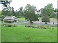
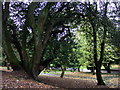
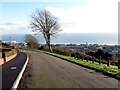
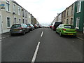
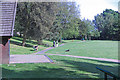
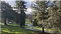
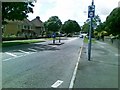
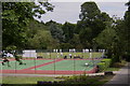
29 photos from this area
Area Information
Key information about the SA1 6NE including its size, population, and administrative classification.
- Area Type
- Postcode
- Area Size
- 1.1 hectares
- Population
- 1426
- Population Density
- 4788 people/km²
House Prices in SA1 6NE
36
Properties
£56,899
Average Sold Price
£22,000
Lowest Price
£84,995
Highest Price
Showing 36 properties
| Address | Type | Beds | Baths | Last Sale Price | Last Sale Date | |
|---|---|---|---|---|---|---|
| 121 Dyfed Avenue, Townhill, Swansea, SA1 6NE | Semi-detached | 3 | 1 | £80,000 | Jan 2021 | |
| 135 Dyfed Avenue, Townhill, Swansea, SA1 6NE | Terraced | - | - | £54,000 | Jul 2007 | |
| 113 Dyfed Avenue, Townhill, Swansea, SA1 6NE | Semi-detached | - | - | £74,000 | Nov 2006 | |
| 127 Dyfed Avenue, Townhill, Swansea, SA1 6NE | Semi-detached | - | - | £84,995 | Jul 2005 | |
| 139 Dyfed Avenue, Townhill, Swansea, SA1 6NE | Terraced | - | - | £26,400 | May 2004 | |
| 120 Dyfed Avenue, Townhill, Swansea, SA1 6NE | house | - | - | £22,000 | Sep 1997 | |
| 128 Dyfed Avenue, Townhill, Swansea, SA1 6NE | Semi-detached | 2 | 1 | - | - | |
| 109 Dyfed Avenue, Townhill, Swansea, SA1 6NE | Terraced | - | - | - | - | |
| 130 Dyfed Avenue, Townhill, Swansea, SA1 6NE | house | - | - | - | - | |
| 117 Dyfed Avenue, Townhill, Swansea, SA1 6NE | house | - | - | - | - |
Page 1 of 4
Energy Efficiency in SA1 6NE
Amenities
Schools
| Rank | School | Type | Entry gender | Ages |
|---|
Explore more schools in this area
Go to Schools tabDemographics
Household Size
Family (3-5 people)
most common
Accommodation Type
Houses
most common
Tenure
51
majority
Ethnic Group
White
most common
Religion
N/A
most common
Household Composition
N/A
most common
Age
47
median
Adults (30-64 years)
most common
Household Deprivation
N/A
with no deprivation
NS-SEC
18
in Lower managerial occupations
Explore more demographic insights in this area
Go to Demographics tabPlanning
Planning Constraints
- Flood RiskPremium
- Ramsar Wetland SitesPremium
- Area of Outstanding Natural BeautyPremium
- Protected Nature ReservePremium
- Protected WoodlandPremium
- Crime RiskPremium