Area Overview for SA1 6JQ
Photos of SA1 6JQ
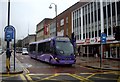
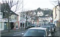
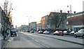
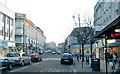
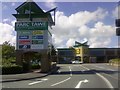

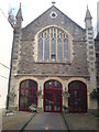
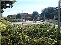
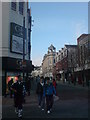

100 photos from this area
Area Information
Key information about the SA1 6JQ including its size, population, and administrative classification.
- Area Type
- Postcode
- Area Size
- 8787 m²
- Population
- 1430
- Population Density
- 5368 people/km²
House Prices in SA1 6JQ
52
Properties
£96,224
Average Sold Price
£27,000
Lowest Price
£158,000
Highest Price
Showing 52 properties
| Address | Type | Beds | Baths | Last Sale Price | Last Sale Date | |
|---|---|---|---|---|---|---|
| 7 Norfolk Street, Mount Pleasant, Swansea, SA1 6JQ | house | 5 | - | £150,000 | Jul 2025 | |
| 39 Norfolk Street, Mount Pleasant, Swansea, SA1 6JQ | Terraced | 3 | 1 | £155,000 | May 2025 | |
| 18 Norfolk Street, Mount Pleasant, Swansea, SA1 6JQ | Terraced | 3 | 1 | £95,100 | Mar 2025 | |
| 25 Norfolk Street, Mount Pleasant, Swansea, SA1 6JQ | Terraced | 4 | 1 | £158,000 | Feb 2023 | |
| 11 NORFOLK STREET, Mount Pleasant, Swansea, SA1 6JQ | Detached | - | - | £65,000 | Feb 2022 | |
| 24 Norfolk Street, Mount Pleasant, Swansea, SA1 6JQ | Terraced | 3 | 1 | £125,000 | Jun 2021 | |
| 14 Norfolk Street, Mount Pleasant, Swansea, SA1 6JQ | Terraced | 5 | 1 | £140,000 | Apr 2021 | |
| 20 Norfolk Street, Mount Pleasant, Swansea, SA1 6JQ | Terraced | 3 | 1 | £130,000 | Feb 2021 | |
| 10 Norfolk Street, Mount Pleasant, Swansea, SA1 6JQ | Terraced | 5 | 1 | £126,000 | Feb 2021 | |
| 34 Norfolk Street, Mount Pleasant, Swansea, SA1 6JQ | Terraced | 3 | 1 | £140,000 | Jan 2021 |
Page 1 of 6
Energy Efficiency in SA1 6JQ
Amenities
Schools
| Rank | School | Type | Entry gender | Ages |
|---|
Explore more schools in this area
Go to Schools tabDemographics
Household Size
One person
most common
Accommodation Type
Houses
most common
Tenure
39
majority
Ethnic Group
White
most common
Religion
N/A
most common
Household Composition
N/A
most common
Age
47
median
Adults (30-64 years)
most common
Household Deprivation
N/A
with no deprivation
NS-SEC
20
in Lower managerial occupations
Explore more demographic insights in this area
Go to Demographics tabPlanning
Planning Constraints
- Flood RiskPremium
- Ramsar Wetland SitesPremium
- Area of Outstanding Natural BeautyPremium
- Protected Nature ReservePremium
- Protected WoodlandPremium
- Crime RiskPremium