Area Overview for SA1 4LX
Photos of SA1 4LX

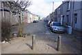
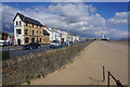
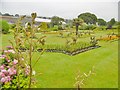
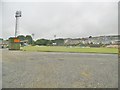
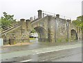
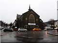
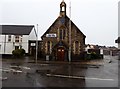
100 photos from this area
Area Information
Key information about the SA1 4LX including its size, population, and administrative classification.
- Area Type
- Postcode
- Area Size
- 5206 m²
- Population
- 1904
- Population Density
- 8432 people/km²
House Prices in SA1 4LX
75
Properties
£157,958
Average Sold Price
£63,950
Lowest Price
£275,000
Highest Price
Showing 75 properties
| Address | Type | Beds | Baths | Last Sale Price | Last Sale Date | |
|---|---|---|---|---|---|---|
| 78 King Edwards Road, Brynmill, Swansea, SA1 4LX | house | - | - | £180,000 | Jul 2025 | |
| 65 King Edwards Road, Brynmill, Swansea, SA1 4LX | Terraced | 3 | 1 | £260,000 | Jun 2025 | |
| 79 King Edwards Road, Brynmill, Swansea, SA1 4LX | Terraced | 5 | 5 | £250,000 | May 2024 | |
| 62 King Edwards Road, Brynmill, Swansea, SA1 4LX | house | 5 | - | £245,000 | Dec 2021 | |
| 75 King Edwards Road, Brynmill, Swansea, SA1 4LX | Terraced | 6 | - | £155,000 | Dec 2018 | |
| 68 King Edwards Road, Brynmill, Swansea, SA1 4LX | house | - | - | £165,000 | Feb 2018 | |
| 64 King Edwards Road, Brynmill, Swansea, SA1 4LX | house | - | - | £120,000 | Apr 2017 | |
| 83 King Edwards Road, Brynmill, Swansea, SA1 4LX | restaurant_cafe | 10 | - | £275,000 | Jun 2016 | |
| 61 King Edwards Road, Brynmill, Swansea, SA1 4LX | Terraced | 2 | 1 | £126,000 | Jan 2016 | |
| 63 King Edwards Road, Brynmill, Swansea, SA1 4LX | house | - | - | £68,500 | Dec 2001 |
Page 1 of 8
Energy Efficiency in SA1 4LX
Amenities
Schools
| Rank | School | Type | Entry gender | Ages |
|---|
Explore more schools in this area
Go to Schools tabDemographics
Household Size
One person
most common
Accommodation Type
Houses
most common
Tenure
24
majority
Ethnic Group
White
most common
Religion
N/A
most common
Household Composition
N/A
most common
Age
22
median
Young Adults (15-29 years)
most common
Household Deprivation
N/A
with no deprivation
NS-SEC
15
in Lower managerial occupations
Explore more demographic insights in this area
Go to Demographics tabPlanning
Planning Constraints
- Flood RiskPremium
- Ramsar Wetland SitesPremium
- Area of Outstanding Natural BeautyPremium
- Protected Nature ReservePremium
- Protected WoodlandPremium
- Crime RiskPremium