Area Overview for SA1 4HG
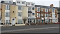
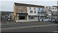
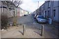
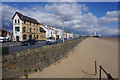
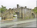
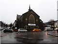
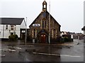
Photos of SA1 4HG


Area Information
Living in SA1 4HG means settling into a small residential cluster located in Wales with a total population of 1,587. This specific postcode area offers a compact community environment where neighbours know each other. The layout focuses entirely on houses, creating a distinct separation from high-rise flats or terraced urban blocks found elsewhere. For those seeking a quiet home base without the noise of a major city centre, this location provides a focused residential experience. You will find that daily life revolves around a tight-knit group of residents who share the same immediate streets. The area acts as a peaceful retreat for young people and families alike while maintaining easy access to the wider Swansea region. There is a sense of calm here that contrasts with the busier surroundings nearby. The small size of the population means services and facilities are often located within a short drive rather than immediately on the doorstep. This area suits individuals who value space and solitude over dense urban convenience. You can observe a steady rhythm to life here, driven by local demographics that skew younger than the national average. The housing stock remains consistent, offering a uniform experience for residents and prospective buyers. Choosing SA1 4HG is a decision to embrace a smaller-scale lifestyle where the focus remains on the home and the immediate neighbourhood rather than distant landmarks.
- Area Type
- Postcode
- Area Size
- Not available
- Population
- 1587
- Population Density
- 10552 people/km²
The property market in SA1 4HG is characterised by a predominance of houses rather than flats or modern developments. With 34% home ownership, the area functions largely as a rental hub for young adults who have just entered the property ladder or cannot afford to buy yet. This low ownership figure suggests that the vast majority of the 1,587 population rents their accommodation. For buyers, this creates a specific market dynamic where finding a buyer can sometimes be challenging if the property is priced above entry level. You will primarily encounter houses designed for the needs of the current age profile, meaning layouts likely suit singles, couples, or small groups rather than large extended families. The lack of multi-story accommodation means you do not need to factor in flats into your search for homes in this postcode. The market reflects a classic Welsh residential pattern where houses dominate the stock. If you are selling, you must price competitively to compete with cheaper rental demand from the many young movers in the region. The area does not cater to the luxury buyer or the family seeking multiple bedrooms and gardens, but rather the young professional or student needing a quiet, isolated house.
House Prices in SA1 4HG
No properties found in this postcode.
Energy Efficiency in SA1 4HG
Residents of SA1 4HG enjoy immediate access to essential amenities within a short distance. There are five retail outlets nearby, including Co-op Swansea, Tesco Swansea St, and another Co-op Swansea location, ensuring you can pick up groceries and household essentials without a long journey. These shops provide a convenient backbone for daily life, meaning you do not need to travel far for your shopping needs. Rail travel is easily accessible with five stations nearby, including Swansea Railway Station, Gowerton Railway Station, and Llansamlet Railway Station. Commuting to work or socialising in the wider region takes minimal planning. Travel options by boat are also available via the Swansea Queens Dock Ferry Terminal, offering a unique method of transport or leisure trip across the water. For air travel, Swansea Airport sits just minutes away, giving you flexibility for both business and holiday travel. This blend of retail, rail, and ferry links creates a lifestyle where you feel connected to the wider world without urban congestion. The character of the area remains residential, but the amenities ensure you are never isolated from the conveniences of a larger city.
Amenities
Schools
Families considering schools near SA1 4HG should note that Terrace Road Primary School is the nearest educational institution. This school is listed as an 'other' type within the local area record. While located nearby, the very young median age of 22 suggests that primary education is not the primary driver for families choosing this specific postcode. Most residents are young adults who either commute from elsewhere or live independently before forming families. The lack of secondary schools or comprehensive colleges in the immediate vicinity means parents will need to commute to find secondary education for their children. Terrace Road Primary School serves as the closest option for younger children, but you should verify catchment boundaries and potential park schools before committing. Given the demographic reality, the area functions more as a place to live than a destination for school-based parents. If you are a family with young children, the proximity to Terrace Road Primary School is a plus, but you must plan for the longer journey to high schools. The current mix of educational facilities supports the needs of those who do settle here permanently, but long-term residents must look beyond this postcode for complete schooling options.
| Rank | School | Type | Entry gender | Ages |
|---|
Explore more schools in this area
Go to Schools tabDemographics
The community profile of SA1 4HG is defined by a very young population with a median age of just 22 years. Most residents fall into the young adult range between 15 and 29 years old. This demographic dominance suggests the area attracts students or early careers rather than older families with school-aged children. Only 34% of households own their homes, which indicates a significant portion of the population rents or shares accommodation. The remaining 66% likely includes private renters, students, or those still establishing financial independence. Accommodation in this area consists exclusively of houses, providing a higher standard of living compared to flats or conversions. The predominant ethnic group is White, reflecting a traditional community makeup within this Welsh postcode. Because the population is so young, you might find fewer elderly residents or retirees compared to older suburbs. This age skew influences local business needs, with demand likely focused on bars, share houses, or entry-level market rentals. The low home ownership rate means many people treat their dwellings as temporary bases rather than permanent family estates. Buying a home here may require different financial planning than purchasing in an area where 70% of residents have been living for decades.
Household Size
Accommodation Type
Tenure
Ethnic Group
Religion
Household Composition
Age
Household Deprivation
NS-SEC
Explore more demographic insights in this area
Go to Demographics tabPlanning
Planning Constraints
- Flood RiskPremium
- Ramsar Wetland SitesPremium
- Area of Outstanding Natural BeautyPremium
- Protected Nature ReservePremium
- Protected WoodlandPremium
- Crime RiskPremium