Area Overview for Killay Community
Photos of Killay Community


Area Information
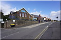
Killay Community is a distinct civil parish situated in Wales, offering a defined residential environment for those considering buying homes in this locality. The parish covers an area of 3.2 km², creating a relatively compact settlement where daily life revolves around close proximities. This specific size suggests a neighbourhood where distances between homes are short, fostering a sense of familiarity among residents. Living in Killay Community means settling into an area with clear boundaries and a structured layout typical of a parish. You are entering a space where the physical scale is manageable, and the character is shaped by its designation as a civil parish rather than a sprawling urban district. The compact nature of the 3.2 km² footprint implies that amenities and neighbours are likely within easy reach. This area provides a straightforward living option for anyone seeking a contained Welsh community without the complexity of larger conurbations. Your potential home will be part of a tightly knit geographic unit where the surroundings are consistent and the scope of the parish is well understood. Whether you visit for the first time or move here permanently, the layout is clear and the context is established by its parish status and physical dimensions.
- Area Type
- Parish
- Area Size
- 3.2 km²
- Population
- Not available
- Population Density
- Not available
Demographics
The community within Killay Community reflects a population heavily weighted towards older residents, with a median age of 70 years. This figure indicates that the majority of people living here belong to the senior demographic. You are looking at an area where retirement or later life living is the norm rather than an exception. The home ownership rate stands at an impressive 84 per cent, suggesting that most properties are owned outright or through mortgages rather than being rented. This high level of tenure creates a stable environment where residents have long-term roots in the parish. Household composition data confirms that the total population includes a significant number of older individuals, aligning with the median age statistics. The accommodation type data covers the total stock, reinforcing that the built environment supports this specific age profile. For anyone considering a move to Killay Community, you should anticipate an atmosphere defined by stability and longevity of tenure. The demographic reality means that social networks are likely built over decades, and the area caters primarily to those with established financial security. Living here involves joining a community where the residents have likely put down roots for many years, making it a place of quiet permanence rather than rapid turnover.
Household Size
Accommodation Type
Tenure
Ethnic Group
Religion
Household Composition
Age
Household Deprivation
NS-SEC
Explore more demographic insights in this area
Go to Demographics tabPlanning
Planning Constraints
- Flood RiskPremium
- Ramsar Wetland SitesPremium
- Protected Nature ReservePremium
- Protected WoodlandPremium
- Crime RiskPremium