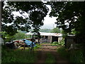
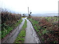
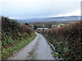
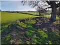
Area Overview for Birchgrove Community
Photos of Birchgrove Community
Area Information
Living in Birchgrove Community offers a distinctly rural experience within a Welsh parish. This civil parish spans 9.1 km² and holds a population of 1,711 residents. The relatively small footprint means services and neighbourhoods are closely knit, yet the area remains characterised by its open space. With a population density of 189 people per km², the parish feels quiet compared to urban centres. You can expect a slower pace of life where the landscape defines daily routines rather than traffic or crowds. The area functions as a standalone parish, providing a sense of independence for those seeking a home away from the bustle of larger towns. The community is rooted in tradition, evident in the high rate of home ownership that defines the residential character. Most neighbours here buy into the area directly, fostering long-term stability within the local streets. This packing style of settlement supports a predictable environment where established patterns prevail. Whether you are looking at homes in Birchgrove Community for retirement or a quiet life, the setting provides a defined boundary between development and nature. Daily life revolves around this specific parish identity, offering a clear sense of locality without the anonymity found in large cities.
- Area Type
- Parish
- Area Size
- 9.1 km²
- Population
- 1711
- Population Density
- 189 people/km²
Demographics
The people of Birchgrove Community place an unusual emphasis on age. The median age stands at exactly 70 years, marking this as a significantly older population compared to the national average. While specific age range breakdowns are not detailed, the high median suggests a community dominated by retirees and established long-term residents. This demographic profile shapes the local services and social fabric, creating an environment where quiet enjoyment and stability are the primary modes of life. You will find very few young families or recent graduates in this specific parish setting. Home ownership remains the dominant mode of residence, with 83% of all households owning their property outright or with a mortgage. This figure underscores the lack of transient renting culture in the area. The remaining 17% of households fall into the rented category, likely comprising a smaller group of those needing to stay flexible within the parish boundaries. The high ownership rate indicates deep community roots rather than a commuter or investment-centric market. Diversity data regarding ethnic groups and religious affiliations is not available for this specific parish. Consequently, the community appears to follow broader regional trends rather than showcasing unique statistical variations in these categories. You should approach the social make-up of Birchgrove Community with the understanding that it reflects a traditional, homogenous rural population without the statistical markers of multicultural urban areas.
Household Size
Accommodation Type
Tenure
Ethnic Group
Religion
Household Composition
Age
Household Deprivation
NS-SEC
Explore more demographic insights in this area
Go to Demographics tabPlanning
Planning Constraints
- Flood RiskPremium
- Ramsar Wetland SitesPremium
- Area of Outstanding Natural BeautyPremium
- Protected Nature ReservePremium
- Protected WoodlandPremium
- Crime RiskPremium