Area Overview for Uplands Community
Photos of Uplands Community
Area Information
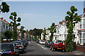
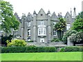
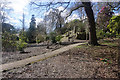
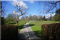
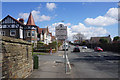
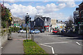
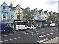
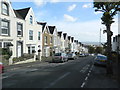
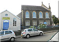
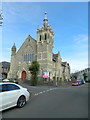
Living in Uplands Community places you within a civil parish that forms a distinct suburb of Swansea, just one mile west of the city centre. This area spans 2.8 km² and sits on hilly terrain centred on the A4118 road, known locally as Walter Road and Sketty Road. The backdrop of high ground gives the neighbourhood a character different from the flatter expanses of neighbouring wards. You find yourself in a location decorated with specific architectural landmarks, including Eaton Crescent, a street of large townhouses renowned in the area, and historic religious buildings like St. James' Church on Walter Road, which opened in 1867. The community has a strong local identity, evidenced by the fact that the Uplands Party won all electoral ward seats in 2022. This political independence reflects a tight-knit population of 15,665 residents who navigate a landscape that blends suburban life with significant vertical challenges. You are not merely guests in Swansea; you are part of a defined electoral unit with its own management and character. Daily life revolves around the A4118 link to the wider city while enjoying a sense of separation provided by the elevation. The presence of multiple places of worship, from the Pantygwydr Baptist Church to Buddhist and Jewish centres, adds depth to the cultural map without cluttering the residential streets.
- Area Type
- Parish
- Area Size
- 2.8 km²
- Population
- Not available
- Population Density
- Not available
Demographics
The people of Uplands Community show a clear demographic focus on later life. With a median age of 70 years, the majority of residents are well into retirement or older age brackets. This statistic defines the social rhythm of the parish, shifting priorities toward amenities like quiet streets and accessible housing rather than nightlife or young-family parties. While the most common age group data tags the total population, the median figure confirms that older adults dominate the daily scene. Home ownership sits at 47 percent, meaning nearly half of the households own their homes outright or with a mortgage. The remaining households consist primarily of private renters or tenants living in the 36 percent of dwellings that are not owner-occupied. This split suggests a market where established families and retirees seek stability, complemented by some investment properties. The area lacks specific data on household composition breakdowns, yet the high median age implies that single-person households or small couples likely outnumber large families. Accommodation variety is present but skewed toward established stock rather than new builds. The area does not report predominant ethnicity or religion statistics in the source data, so the cultural landscape remains understated in official counts. Despite this, the ground reality includes a range of faith communities established over the last century. Deprivation metrics are not available to quantify economic hardship, but the ownership rate and age profile suggest a stable, established community rather than a transient or high-poverty zone. Living here means engaging with a population that has put down deep roots in Swansea.
Household Size
Accommodation Type
Tenure
Ethnic Group
Religion
Household Composition
Age
Household Deprivation
NS-SEC
Explore more demographic insights in this area
Go to Demographics tabPlanning
Planning Constraints
- Flood RiskPremium
- Ramsar Wetland SitesPremium
- Area of Outstanding Natural BeautyPremium
- Protected Nature ReservePremium
- Protected WoodlandPremium
- Crime RiskPremium