Area Overview for Landore Community
Photos of Landore Community
Area Information
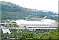
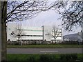
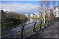
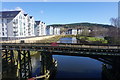
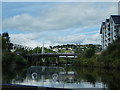
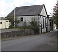
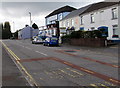
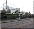
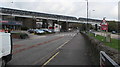
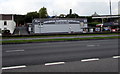
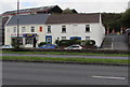
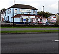
Landore Community is a civil parish situated within Swansea, Wales, covering an area of 2.2 km². You will find this district approximately 2.5 miles north of the city centre, nestled along the River Tawe. Historically, this location was an industrial powerhouse, hosting major copper smelting and steelworks. Landore now exists as a mainly residential district that retains a distinct post-industrial feel. The area encompasses the north-easterly district of Morfa, which contributes to its mixed character. A population of 6,168 calls this location home according to the 2011 census. Daily life here balances urban living with significant green spaces. You can access the Swansea.com Stadium, formerly known as Liberty Stadium, and the Landore Bowls Stadium. The Landore Viaduct stands as a key landmark, offering views over the river. Morfa Shopping Park opened in 2005 to serve local needs. While the area reflects its heritage, it has undergone substantial regeneration since the 1960s. Development created enterprise zones and replaced dereliction with commercial and retail facilities. Living in Landore offers a connection to Swansea's industrial past alongside modern amenities.
- Area Type
- Parish
- Area Size
- 2.2 km²
- Population
- Not available
- Population Density
- Not available
Demographics
Your understanding of Landore Community relies on the specific census data available. The 2011 census recorded a total population of 6,168 residents. This figure represents a stable community size for a civil parish of this dimension. Because specific breakdowns regarding age profiles and household types are not included in the current dataset, precise claims about demographics remain beyond our scope. We cannot state the percentage of pensioners, children, or working-age adults. Information regarding home ownership levels and deprivation data is also not provided. Consequently, we cannot quantify how many residents own their properties outright versus renting, nor can we rank the area against national averages for wealth. The available research does not specify the typical household size or the proportion of single-person households. Without these statistics, any discussion of the community's social mix lacks factual backbone. Similarly, there is no data available to describe the diversity of the population in terms of ethnicity or nationality. While the area has served as a working-class stronghold due to its industrial history, the exact current composition is not captured in the provided figures. You must treat these demographic characteristics as unknown based on the records.
Household Size
Accommodation Type
Tenure
Ethnic Group
Religion
Household Composition
Age
Household Deprivation
NS-SEC
Explore more demographic insights in this area
Go to Demographics tabPlanning
Planning Constraints
- Flood RiskPremium
- Ramsar Wetland SitesPremium
- Area of Outstanding Natural BeautyPremium
- Protected Nature ReservePremium
- Protected WoodlandPremium
- Crime RiskPremium