Area Overview for Cockett Community
Photos of Cockett Community


Area Information
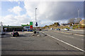
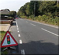
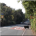
Cockett Community is a civil parish located in Wales with a defined footprint of 5.8 square kilometres. The population stands at 1,434 residents, creating a very specific living environment within the South Wales Valleys. You find yourself in a tightly knit setting where density reaches 1,422 people per square kilometre. This figure indicates a concentrated community rather than sprawling development. The character of living in Cockett Community is shaped by these confined boundaries and a substantial resident base relative to the land area. Daily life here involves navigating a neighbourhood where residents share limited physical space, which often fosters strong local connections. The parish distinguishes itself through its demographic profile, which leans heavily towards older age groups. This concentration of older residents shapes the cultural rhythm of the area, influencing local services and community activities. Homes in Cockett Community reflect this demographic reality, with a majority of households likely occupied by those in later life stages. The area does not boast vast commercial zones or heavy industrial sprawl due to its small total area, meaning daily routines often centre on established local amenities or travel to wider towns. You are entering an established Welsh parish with a clear identity. The compact nature of the parish means that noise, traffic, and neighbourly interactions are immediately felt. This is not an area for those seeking seclusion from the bustle of neighbours, as the population density is high for a rural-style parish. Instead, it offers a defined sense of place. Living in this parish requires an appreciation of its specific historical and social context, which is deeply rooted in the legacy of its residents.
- Area Type
- Parish
- Area Size
- 5.8 km²
- Population
- 1434
- Population Density
- 1422 people/km²
Demographics
The community in Cockett Community displays a distinct shift towards retirement living. The median age is 70 years old, meaning half the population is older than this mark. This age profile defines the social fabric of the parish. Most data categorises the age distribution broadly under the label "Age: Total", confirming that the resident base is significantly older than the national average. You are looking at an area where schools serving young families are less common than residential facilities catering to seniors. Home ownership is a dominant feature here. A full 62 per cent of residents own their homes outright or with a mortgage. This high rate of ownership suggests stability within the neighbourhood. Long-term residents have likely maintained ties to Cockett Community for decades. The household composition data aggregates the total picture without breaking down specific family structures, but the high ownership percentage implies fewer private landlords and more owner-occupied dwellings. Accommodation types within the parish follow the general pattern of total accommodation statistics found across the region. The ethnic demographics are similarly aggregated under total predominance, reflecting the historically established nature of the Welsh valleys. Religious affiliation data is also recorded at the total level, indicating traditional demographics common to the area. Deprivation and income data are not explicitly detailed in the current figures, but the high home ownership rate often correlates with financial stability among the elderly population. The community is predominantly occupied by people who have achieved some level of economic security, contributing to a calm residential atmosphere.
Household Size
Accommodation Type
Tenure
Ethnic Group
Religion
Household Composition
Age
Household Deprivation
NS-SEC
Explore more demographic insights in this area
Go to Demographics tabPlanning
Planning Constraints
- Flood RiskPremium
- Ramsar Wetland SitesPremium
- Area of Outstanding Natural BeautyPremium
- Protected Nature ReservePremium
- Protected WoodlandPremium
- Crime RiskPremium