Area Overview for St. Thomas Community
Photos of St. Thomas Community


Area Information
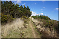
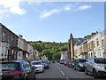
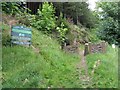
St. Thomas Community is a compact unitary electoral division covering an area of 3.3 km² in Wales. This small footprint creates a neighbourhood where distances are short and local access is immediate. The character of living in St. Thomas Community is defined by its low population density and mature demographic profile. Homes in St. Thomas Community sit within an environment that balances residential living with significant natural planning constraints. A defining feature of the landscape is the presence of Ramsar wetland sites and protected nature reserves. These designations impose strict planning controls on development. You will find no coverage within an Area of Outstanding Natural Beauty, yet the protected status of the local reserves remains a critical factor for any builder or developer. Residents enjoy a very low flood risk profile, with the area scoring 7.36 on a scale where lower numbers indicate less danger. While crime data is not available for Wales, the environmental safety record is robust. The community serves as a distinct enclave where nature conservation takes precedence over urban expansion. This balance ensures that the land remains largely untouched for future generations.
- Area Type
- Parish
- Area Size
- 3.3 km²
- Population
- Not available
- Population Density
- Not available
Demographics
The people of St. Thomas Community reflect a mature population where the median age stands at 70. This demographic means households typically comprise retired individuals or older families rather than young professionals raising children. The community reports a consistent age profile without the broad spread seen in larger urban centres. Home ownership rates stand at 54%, indicating that nearly half of the residents own their homes outright or with a mortgage. This majority suggests a stable, settled population with strong roots in the locality. The remaining households represent those who rent or do not own property, though a majority of residents are free to build equity in their own dwellings. Specific data regarding household composition, accommodation types, and ethnic diversity is not detailed in the available report, preventing a granular analysis of social mix. Despite this, the high home ownership percentage implies a community built on long-term residency rather than transient renting. The lack of young families in the statistical breakdown points toward a retirement-oriented settlement. Living here appeals to those seeking quiet neighbourhoods rather than active family hubs.
Household Size
Accommodation Type
Tenure
Ethnic Group
Religion
Household Composition
Age
Household Deprivation
NS-SEC
Explore more demographic insights in this area
Go to Demographics tabPlanning
Planning Constraints
- Flood RiskPremium
- Ramsar Wetland SitesPremium
- Area of Outstanding Natural BeautyPremium
- Protected Nature ReservePremium
- Protected WoodlandPremium
- Crime RiskPremium