Area Overview for Penllergaer Community
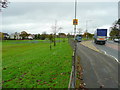
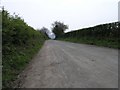
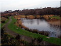
Photos of Penllergaer Community
Area Information
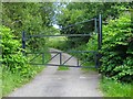
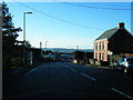
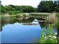
Living in Penllergaer Community offers a distinct experience rooted in more than 500 years of Welsh history. This civil parish covers an area of 6.1 km² on the north-west fringe of Swansea in South West Wales. The community developed separately from the historic Penllergare estate, which began as Cors Eynon in the latter part of the 19th century. Today, you are neighbours with a landmark that spans over 100 hectares of mixed woodland known as Penllergare Valley Woods. The village sits close to Junction 47 of the M4 motorway, providing major road access to the wider region. The area is defined by a conservation-minded character due to its proximity to a registered Grade II country park and an observatory constructed between 1851 and 1852. You can explore seven miles of woodland walks along the River Llan, which features a spectacular waterfall. The landscape includes two lakes and extensive horticultural collections, reflecting the pioneering work of John Dillwyn Llewelyn. While the original mansion was demolished in 1961, the estate remains a powerful presence with its woods and historic structures. The principal creator of the gardens was a photographer and astronomer, meaning the natural environment holds significant cultural weight. You live in a setting where modern residential life overlaps with a legacy of scientific exploration and botanical innovation.
- Area Type
- Parish
- Area Size
- 6.1 km²
- Population
- Not available
- Population Density
- Not available
Demographics
The community profile of Penllergaer Community is dominated by older residents. The median age for the population is 70 years old, indicating a significant concentration of older households. The data does not specify the most common age range beyond stating the total age distribution. Seven and a half percent of the population do not fall into a specific demographic category listed in the most common age range field, reflecting the unique profile of this age-heavy village. Home ownership stands at 76 percent, a figure that aligns with the area's history as a settled, long-term community. The remaining 24 percent of residents live in rented accommodation or other forms of tenure. Household composition data is recorded as total without a specific breakdown provided in the source material. You can expect to live amongst neighbours who have often resided in the area for generations. The population composition regarding predominant ethnic groups and religious affiliations is listed as total in the available data, suggesting a homogeneous community structure. This high rate of home ownership combined with an aging population creates a quiet, established atmosphere in the parish. The lack of young families in the specific data suggests the area may appeal more to retirees than those with growing children seeking active family neighbourhoods.
Household Size
Accommodation Type
Tenure
Ethnic Group
Religion
Household Composition
Age
Household Deprivation
NS-SEC
Explore more demographic insights in this area
Go to Demographics tabPlanning
Planning Constraints
- Flood RiskPremium
- Ramsar Wetland SitesPremium
- Area of Outstanding Natural BeautyPremium
- Protected Nature ReservePremium
- Protected WoodlandPremium
- Crime RiskPremium