Area Overview for Penderry Community
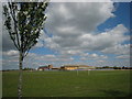
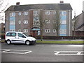
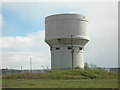
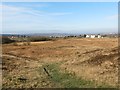
Photos of Penderry Community


Area Information
Penderry Community sits as a distinct civil parish south of Newport, covering a compact area of 3.8 km². You will find 3,411 residents living within these boundaries, resulting in a population density of 890 people per square kilometre. This demographic concentration creates a closely knit environment where neighbours often know one another. The area serves as a residential hub for those choosing to live in Penderry Community rather than commuting from further afield. Daily life here balances suburban convenience with the intimacy of a smaller village setting. The parish structure provides a clear local identity that helps define the neighbourhood character. You can expect a community pace that suits families and long-term residents who value proximity to key amenities. The compact size means most daily errands remain local without the need for lengthy travel. Living here offers a sense of belonging within a defined and manageable geographical space. This residential focus makes Penderry Community a practical choice for those seeking a stable neighbourhood.
- Area Type
- Parish
- Area Size
- 3.8 km²
- Population
- 3411
- Population Density
- 890 people/km²
Demographics
Your neighbours in Penderry Community reflect a mature profile with a median age of 70. This indicates that a significant portion of the population comprises older adults who have called this parish home for decades. The household composition data as a total reveals the intricate mix of family units and single-occupancy homes that make up the street furniture. Home ownership stands at 34 per cent, meaning the majority of residents either rent or hold tenures other than full ownership. This rental-leaning status suggests an area with a dynamic pool of occupants rather than a static, single-generational community. The total accommodation types figure underscores the variety of housing solutions available to current and future residents. You will encounter a mix of tenure arrangements that define the social fabric of Penderry Community. The age profile means that community services and amenities likely cater to an older demographic. Understanding this helps you gauge the local rhythm and social interactions within the parish. The 34 per cent ownership rate is a specific fact you should note when considering your own future in the area.
Household Size
Accommodation Type
Tenure
Ethnic Group
Religion
Household Composition
Age
Household Deprivation
NS-SEC
Explore more demographic insights in this area
Go to Demographics tabPlanning
Planning Constraints
- Flood RiskPremium
- Ramsar Wetland SitesPremium
- Area of Outstanding Natural BeautyPremium
- Protected Nature ReservePremium
- Protected WoodlandPremium
- Crime RiskPremium