Area Overview for Llwchwr Community
Photos of Llwchwr Community
Area Information
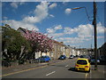
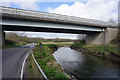
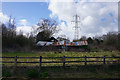
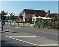
Llwchwr Community is a civil parish situated in the central western part of Swansea, Wales. You will find it lies nine kilometres west-north-west of the city centre, bounded by Gorseinon to the north, Penllergaer to the east, and Gowerton to the south. The River Loughor estuary forms its western boundary. This community encompasses the town of Loughor, the adjacent village of Kingsbridge, and the area of Llewitha. A total of 3,623 people live across an area size of 7.6 square kilometres. Llwchwr contains the historic settlement of Upper Loughor and Kingsbridge, which evolved from small hamlets during the nineteenth century. The region traces its history to the Roman fort of Leucarum, which stood before the Norman Loughor Castle was built in 1106. Rapid population influx during the twentieth century saw the establishment of a Garden Village inspired by Ebenezer Howard's principles. Today, the locality functions primarily as a residential area served by Llwchwr Town Council. You will encounter significant landmarks such as Loughor Castle and Moriah chapel, which commemorates a major religious revival from 1904–05. Homes in Llwchwr sit within a landscape that retains historical industrial significance alongside residential calm. Living in Llwchwr offers access to these historical sites and the practical connectivity of the surrounding Swansea neighbourhood.
- Area Type
- Parish
- Area Size
- 7.6 km²
- Population
- 3623
- Population Density
- 476 people/km²
Demographics
The community demographics reveal a distinct age profile within Llwchwr. The median age stands at 70, indicating a mature population. This figure suggests you are likely to encounter an area dominated by older residents. Home ownership levels are exceptionally high, with 80% of households owning their property. This indicates a settled community where long-term residents form the backbone of the local population. The household composition data confirms the total headcount without specifying single-person or family unit breakdowns. Accommodation types are also recorded as a total figure without specific segmentation. Regarding diversity, the predominant ethnic group is listed as a total without further ethnic breakdown. Similarly, religious affiliation follows the total classification. The population density calculates to 476 people per square kilometre based on the total population and area size. This density level places Llwchwr firmly within residential zones rather than dense urban cores. You will find a stable demographic environment characterised by high ownership rates and an older median age. Schools near Llwchwr provide education for the younger generations, supporting families who reside in these homes.
Household Size
Accommodation Type
Tenure
Ethnic Group
Religion
Household Composition
Age
Household Deprivation
NS-SEC
Explore more demographic insights in this area
Go to Demographics tabPlanning
Planning Constraints
- Flood RiskPremium
- Ramsar Wetland SitesPremium
- Area of Outstanding Natural BeautyPremium
- Protected Nature ReservePremium
- Protected WoodlandPremium
- Crime RiskPremium