Area Overview for Llangyfelach Community
Photos of Llangyfelach Community

Area Information
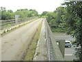
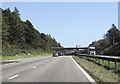
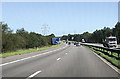
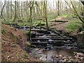
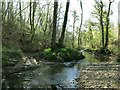
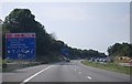
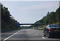
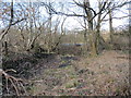
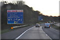
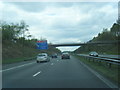
Living in Llangyfelach Community offers a specific blend of rural tranquility and accessible proximity to Swansea. This small civil parish covers an area of 12.0 km² and sits roughly four miles north of Swansea city centre. The location sits just west of Morriston, bordered by open moorland to the west and the M4 motorway to the north. A population of 2,371 residents calls this place home, according to the 2021 census. The settlement dates back to the 6th century when St David founded a Celtic monastery. The name derives from the saint Cyfelach. Historical records show the site was involved in 12th-century diocese boundary disputes. Today, the Parish Church of St David and Cyfelach stands as a central landmark featuring a 12th-century detached tower. You will find a converted tithe barn and a 9th-century Celtic cross within the parish grounds. The former Felindre tinplate works now hosts sites linked to the National Eisteddfod. Painter Evan Walters was born in this area. Daily life revolves around the primary school, a post office, and the Plough and Harrow pub. The proximity of the M4 motorway at Junction 46 ensures straightforward access to wider networks while the moorland setting preserves a quiet atmosphere.
- Area Type
- Parish
- Area Size
- 12.0 km²
- Population
- Not available
- Population Density
- Not available
Demographics
The community of Llangyfelach displays a clear age profile with a median age of 70 years old. This figure indicates a population skewed significantly towards older residents rather than families with young children. You will encounter the highest density of residents in the age group spanning from older adulthood through to retirement years. The social fabric is heavily defined by property tenure, with 82% of households owning their home outright or with a mortgage. This high rate of home ownership suggests long-term stability and rootedness within the parish. The remaining residences are likely held by private landlords or rentable stock given the remaining percentage. There is no specific data recorded regarding the household composition breakdowns or detailed ethnic diversity statistics. Consequently, you cannot determine the precise mix of family units, single-person households, or shared living arrangements from available records. Similarly, information concerning the predominant ethnic group or specific religious affiliations of the population is absent from the dataset. While the area is anchored by the St David and Cyfelach church structure and historical Protestant chapel from 1801, detailed modern demographic profiling remains limited. The overwhelming descriptor for any resident profile is an older demographic living in majority owner-occupied homes.
Household Size
Accommodation Type
Tenure
Ethnic Group
Religion
Household Composition
Age
Household Deprivation
NS-SEC
Explore more demographic insights in this area
Go to Demographics tabPlanning
Planning Constraints
- Flood RiskPremium
- Ramsar Wetland SitesPremium
- Area of Outstanding Natural BeautyPremium
- Protected Nature ReservePremium
- Protected WoodlandPremium
- Crime RiskPremium