Area Overview for Ynysybwl and Coed-y-Cwm Community
Photos of Ynysybwl and Coed-y-Cwm Community
Area Information
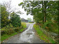
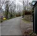
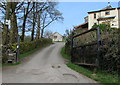
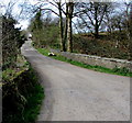
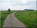
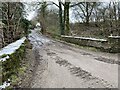
Ynysybwl and Coed-y-Cwm Community sits within the county borough of Rhondda Cynon Taf, positioned roughly 15 miles north-north-west of Cardiff and eight miles north of the market town of Pontypridd. This civil parish covers an area of 19.6 km² and consists primarily of two villages nestled in the valleys. The area carries a deep industrial past, transforming from a rural collection of farms in the 1840s into a coal mining hub after the Earl Windsor Colliery opened in 1884. Although the colliery closed fully in 1988, the character of this community remains defined by close-knit locals and a history rich in regeneration efforts. Residents often refer to the village locally as "Bwl" or "The Bwl," highlighting its post-industrial resilience through active community groups and churches. Daily life here involves commuting to nearby employment centres such as Treforest Trading Estate and Aberdare, while the landscape retains its valley features. Living in Ynysybwl and Coed-y-Cwm Community means engaging with a population that has survived major economic shifts through strong local councils and associative networks. The area is bounded by Llanwynno forestry to the north and relies on proximity to Pontypridd for significant services. This distinct identity combines historical heritage with modern communal focus.
- Area Type
- Parish
- Area Size
- 19.6 km²
- Population
- Not available
- Population Density
- Not available
Demographics
The population profile of Ynysybwl and Coed-y-Cwm Community reveals a distinctly older demographic compared to many urban centres. The median age stands at 70 years, indicating a community where retirees and older adults make up a significant portion of the residents. While the data does not specify individual age brackets beyond this median, the high average suggests a quiet retirement environment rather than a family-heavy zone. Home ownership is the dominant tenure model, with 68 percent of households owning their properties outright or with a mortgage. This high rate of ownership implies stability and a settled population that has root mi in the area. The accommodation data confirms that the total stock consists of varied dwelling types, though the absence of rental market specifics highlights the premium placed on ownership by locals. There is no specific data provided regarding ethnic diversity or religious affiliations within the parish records available for this analysis. The household composition data reflects a total count that aligns with the aging population trend. Living in Ynysybwl and Coed-y-Cwm Community means joining a demographically mature society where many residents have spent their lives within the Rhondda valleys.
Household Size
Accommodation Type
Tenure
Ethnic Group
Religion
Household Composition
Age
Household Deprivation
NS-SEC
Explore more demographic insights in this area
Go to Demographics tabPlanning
Planning Constraints
- Flood RiskPremium
- Ramsar Wetland SitesPremium
- Area of Outstanding Natural BeautyPremium
- Protected Nature ReservePremium
- Protected WoodlandPremium
- Crime RiskPremium