Area Overview for Ynyshir Community
Photos of Ynyshir Community


Area Information
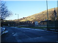
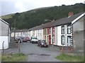
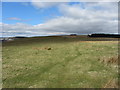
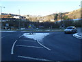
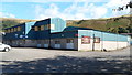
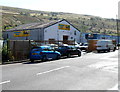
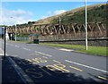
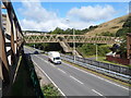
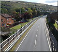
Ynyshir Community is a small civil parish located in the Rhondda Fach Valley within Rhondda Cynon Taf, South Wales. This historic area covers 4.4 km² and sits strategically between Wattstown and the larger town of Porth. The name Ynyshir translates to "long island" or "long riverside meadow" in Welsh, reflecting its agricultural origins before the mid-19th century. The modern village layout was largely established by 1900, driven by the expansion of deep coal mining and the arrival of the Taff Vale Railway in 1849. Today, the population stands at approximately 1,558 residents. You will find yourself in a locality rich with industrial heritage, having hosted the pioneering Ynyshir Coal Mine since 1845. The area maintains a distinct identity separate from the immediate urban sprawl of Porth while remaining connected to it. Living in Ynyshir Community offers a settled village experience rooted in Welsh history. Notable local institutions include St. Anne's parish church and the Ynyshir Standard Colliery Workmen's Hall, which opened in 1905. The environment is defined by its valley position and proximity to historic sites like Standard Collieries and Lady Lewis Colliery.
- Area Type
- Parish
- Area Size
- 4.4 km²
- Population
- Not available
- Population Density
- Not available
Demographics
The demographic profile of Ynyshir Community reveals a mature and established population. The median age for residents is 70, indicating that the community is predominantly populated by older individuals. Age data shows a concentration in the total age range, confirming this is an area where younger families and children are less common. Regarding property tenure, 63% of households own their homes, suggesting a stable, owner-occupied environment rather than a transient rental market. This high rate of ownership typically aligns with the older resident profile and the availability of family-sized accommodation. The area is a civil parish with a population of around 1,558 people. Specific details regarding household composition, predominant ethnic groups, and religious affiliations are not included in the provided specifications. You are dealing with a neighbourhood characterised by longevity and stability. The lower median age compared to other UK regions points to a retirement-friendly location or a village where younger generations have historically moved away for work, returning to an established community network.
Household Size
Accommodation Type
Tenure
Ethnic Group
Religion
Household Composition
Age
Household Deprivation
NS-SEC
Explore more demographic insights in this area
Go to Demographics tabPlanning
Planning Constraints
- Flood RiskPremium
- Ramsar Wetland SitesPremium
- Area of Outstanding Natural BeautyPremium
- Protected Nature ReservePremium
- Protected WoodlandPremium
- Crime RiskPremium