Area Overview for Trehafod Community
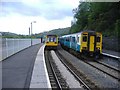
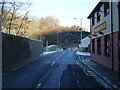
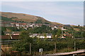
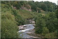
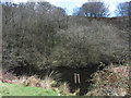
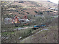
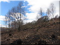
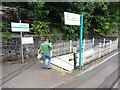
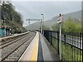
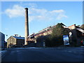
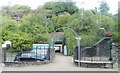
Photos of Trehafod Community
Area Information
Living in Trehafod Community offers a defined rural experience within a civil parish that spans just 1.9 square kilometres. This compact size suggests a close-knit environment where distances are short and the local geography shapes daily routines. The area sits within Wales, presenting a specific regional character distinct from other UK settlements. You will find a setting where the limitations of a small parish define the scope of local life, from access to services to the breadth of green space available. Being a civil parish, Trehafod Community operates under specific local governance structures that manage community affairs. The physical scale of the area means that every development or change directly impacts the immediate surroundings of residents. For those considering homes in Trehafod Community, the location provides a static, manageable footprint without the sprawl of larger urban developments. The area's identity remains rooted in its status as a parish, which often correlates with quieter, more subdued living conditions compared to busy towns. You are entering a space where the natural boundaries of the parish likely dictate the view from your windows and the length of your commute to nearby amenities.
- Area Type
- Parish
- Area Size
- 1.9 km²
- Population
- Not available
- Population Density
- Not available
Demographics
The population profile of Trehafod Community points clearly towards retirement and older demographics. The median age across the area stands at 70 years, confirming that this is predominantly a retirement destination. This age distribution suggests you will encounter neighbours who are well past their working lives, likely enjoying a slower pace. Because the most common age group is marked as 'Total', detailed breakdowns for younger cohorts are not explicitly defined in current records. Consequently, the community functions as a settled ground for seniors rather than a hub for families seeking nearby schools or playgrounds. Home ownership is entrenched in the local fabric, with 79% of households owning their property outright. This high level of ownership indicates stability and long-term roots, as residents are less likely to move frequently in search of rental accommodation. The accommodation types and predominant ethnic groups are recorded as totals, meaning specific diversity metrics are not broken down further. You should expect a homogenous community where the majority of people share similar life stages and tenure statuses. For those researching living in Trehafod Community, the demographic reality is one of established residency rather than transient or young-family housing.
Household Size
Accommodation Type
Tenure
Ethnic Group
Religion
Household Composition
Age
Household Deprivation
NS-SEC
Explore more demographic insights in this area
Go to Demographics tabPlanning
Planning Constraints
- Flood RiskPremium
- Ramsar Wetland SitesPremium
- Area of Outstanding Natural BeautyPremium
- Protected Nature ReservePremium
- Protected WoodlandPremium
- Crime RiskPremium