Area Overview for Pont-y-clun Community
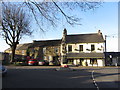
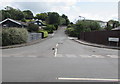
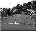
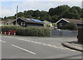
Photos of Pont-y-clun Community


Area Information
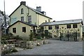
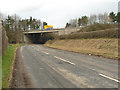
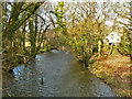
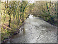
Pont-y-clun Community is a civil parish located within the county borough of Rhondda Cynon Taf, Wales. This area spans 11.9 km² and currently holds a population of 2,031 residents. Life here centres around the River Clun, which gave the town its name, meaning the bridge over the tree-shrouded waterway. The parish has evolved from a Victorian industrial hub driven by railways and mining to a modern residential community. You can find historic landmarks such as St Paul's Church and the Pontyclun Institute, which now serves as the Athletic Club. The town gained official town status in September 2023, marking a significant milestone for the local council formed in 1985. Your daily living experience here is shaped by the parish's dense layout, with a population density of 1,470 people per square kilometre. This density suggests you will find community spaces and local facilities within easy reach. The location offers a tangible connection to a rich industrial history, with evidence of human activity dating back over 5,000 years to the Stone Age. Roman iron smelters and Norman castles dot the wider landscape nearby. You are looking at a settlement that balances its past as a centre for coal and tinplate production with the quiet rhythm of contemporary Welsh village life. Living in Pont-y-clun Community means embracing a locale defined by its Purple-washed churches and the narrow valleys of the Rhondda Valley.
- Area Type
- Parish
- Area Size
- 11.9 km²
- Population
- 2031
- Population Density
- 1470 people/km²
Demographics
The community of Pont-y-clun Community has a distinct age profile, with a median age of 70. You will encounter an older population characterised by mature residents and retirees rather than families with young children. The household composition data indicates a settled community where older generations tend to stay in their homes. Home ownership stands at an impressive 83 per cent, showing that the vast majority of residents are mortgage-free homeowners. This high rate suggests you are entering a market where many houses have remained in the hands of the same family for several decades. You do not need to worry about property shortages or rental fluctuations because the housing stock is predominantly occupied. The accommodation type survey confirms that the majority of the 2,031 residents live in properties they own outright. There is no significant transient population, which creates a stable environment for any new buyers you consider settling down. While specific data on ethnicity and religion are not detailed in the provided demographics, the high home ownership rate typically correlates with established neighbourhoods where community ties run deep. The low population density relative to urban centres means you can expect a quieter life compared to busier Welsh towns.
Household Size
Accommodation Type
Tenure
Ethnic Group
Religion
Household Composition
Age
Household Deprivation
NS-SEC
Explore more demographic insights in this area
Go to Demographics tabPlanning
Planning Constraints
- Flood RiskPremium
- Ramsar Wetland SitesPremium
- Area of Outstanding Natural BeautyPremium
- Protected Nature ReservePremium
- Protected WoodlandPremium
- Crime RiskPremium