Area Overview for Llanharan Community
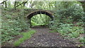
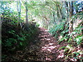
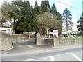
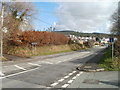
Photos of Llanharan Community
Area Information
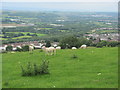
Llanharan Community stands as a distinct civil parish within Rhondda Cynon Taf, Wales. This area spans 23.3 km² and sustains a population of 1,512 people. You will find communities including Llanharan, Brynna, Brynna Gwynion, Bryncae, Llanilid, and Ynysmaerdy all falling under this single parish structure. The postcode CF72 8XQ covers the region, placing it near the historical centre of activity. Historically, the Powell family built the Georgian section of Llanharan House by 1756, marking a legacy that predates the industrial expansion brought by the South Wales Railway in 1850. While early industries included iron mines near Pontyclun and later coal mining, the physical traces of these operations have largely faded from view today. The Llanharan Community Council, formed in 1974, continues to represent the settlement's needs as a successor to former parish councils. Living in Llanharan means engaging with a parish that retains its ancient roots while functioning within the modern county borough framework.
- Area Type
- Parish
- Area Size
- 23.3 km²
- Population
- 1512
- Population Density
- 65 people/km²
Demographics
The demographic profile of Llanharan Community reflects a settled, older population. Residents here have a median age of 70, indicating a significant proportion of the parish is made up of older adults. You will find this concentration of older households typical for a village with deep historical roots and limited recent high-density development. Home ownership is exceptionally high at 78%, meaning the vast majority of households are owner-occupied rather than renting. This statistic suggests stability and long-term residence for most families within the parish boundaries. The accommodation types and household composition data confirm a traditional settlement pattern where stability is the norm. There are no specific figures listed for predominant ethnic groups or religious affiliations in the current records, but the home ownership rate remains a clear defining feature. For those considering homes in Llanharan, the data points to a quiet, established environment where families and older residents have put down roots for the long term. The low population density of 65 people per km² supports the view that this is a spacious, low-intensity living environment.
Household Size
Accommodation Type
Tenure
Ethnic Group
Religion
Household Composition
Age
Household Deprivation
NS-SEC
Explore more demographic insights in this area
Go to Demographics tabPlanning
Planning Constraints
- Flood RiskPremium
- Ramsar Wetland SitesPremium
- Area of Outstanding Natural BeautyPremium
- Protected Nature ReservePremium
- Protected WoodlandPremium
- Crime RiskPremium