Area Overview for Cymmer Community
Photos of Cymmer Community

Area Information
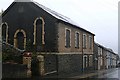
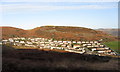
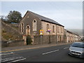
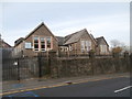
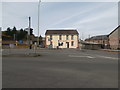
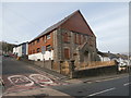
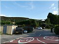
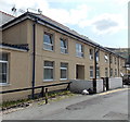
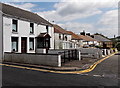
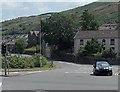
Cymmer Community sits as a civil parish in the Rhondda Valley, covering an area of 3.5 square kilometres. Located at the confluence of the Rhondda Fawr and Rhondda Fach rivers, the village lies approximately halfway between Treorchy and Pontypridd. Neighbouring Trehafod forms part of the same electoral ward, which held a population of 5,505 in 2011. The settlement is defined by its historical significance rather than modern commercial development. The Welsh Congregational Church was founded in 1738, followed by the Cymmer Independent Chapel in 1743. This chapel holds the distinction of being the first nonconformist chapel in the Rhondda, linked to revivalist Howel Harris. Coal mining began in the mid-19th century, with specific collieries sunk from 1847 onwards. A major disaster occurred at Cymmer Colliery in 1856, resulting in the death of 114 miners. The writer and broadcaster Gwyn Thomas was born and raised in this location. Local government representation shifted over time, evolving from unelected magistrates pre-1889 to Glamorgan County Council until 1974. The area eventually became part of Rhondda Cynon Taf County Borough in 1996. Residents today live in a setting shaped by this deep industrial past and proximity to Pontypridd.
- Area Type
- Parish
- Area Size
- 3.5 km²
- Population
- Not available
- Population Density
- Not available
Demographics
The community profile shows a median age of 70 years, indicating a retirement-aged population. The most common age range recorded is simply labelled as Age: Total, suggesting a concentration of older residents within the parish. Home ownership stands at 64 per cent, placing Cymmer Community firmly within the owner-occupied sector. More than half of the residents are not tenants, which typically suggests larger, permanent housing stocks. The available documentation lists household composition and accommodation types as total categories without further specific breakdowns provided for this location. This single data point reinforces the finding that residents predominantly own their dwellings. The parish does not list specific details for predominant ethnic groups or religious affiliations in the current dataset. These absences prevent a detailed analysis of cultural diversity. The overall picture points towards a stable, settled community where long-term residents hold their property. A sixty-four per cent ownership rate implies that new buy-to-let investors are less likely to dominate the local market. The high median age supports the observation that this is a place for those seeking retirement housing rather than a family destination.
Household Size
Accommodation Type
Tenure
Ethnic Group
Religion
Household Composition
Age
Household Deprivation
NS-SEC
Explore more demographic insights in this area
Go to Demographics tabPlanning
Planning Constraints
- Flood RiskPremium
- Ramsar Wetland SitesPremium
- Area of Outstanding Natural BeautyPremium
- Protected Nature ReservePremium
- Protected WoodlandPremium
- Crime RiskPremium