Area Overview for CF72 9ZD
Photos of CF72 9ZD
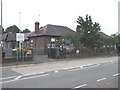

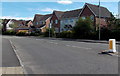
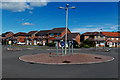
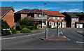
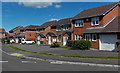
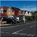
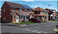
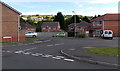
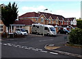
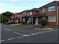
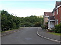
61 photos from this area
Area Information
Key information about the CF72 9ZD including its size, population, and administrative classification.
- Area Type
- Postcode
- Area Size
- 1.8 hectares
- Population
- 2990
- Population Density
- 284 people/km²
House Prices in CF72 9ZD
56
Properties
£184,251
Average Sold Price
£121,000
Lowest Price
£449,950
Highest Price
Showing 56 properties
| Address | Type | Beds | Baths | Last Sale Price | Last Sale Date | |
|---|---|---|---|---|---|---|
| 27 Ffordd Y Dolau, Llanharan, CF72 9ZD | Detached | 4 | 3 | £449,950 | Sep 2025 | |
| 67 Ffordd Y Dolau, Llanharan, CF72 9ZD | Detached | 3 | 1 | £300,000 | Dec 2024 | |
| 79 Ffordd Y Dolau, Llanharan, CF72 9ZD | Detached | 3 | 1 | £260,000 | Jun 2024 | |
| 101 Ffordd Y Dolau, Llanharan, CF72 9ZD | Semi-detached | 3 | 1 | £230,000 | Nov 2023 | |
| 97 Ffordd Y Dolau, Llanharan, CF72 9ZD | Semi-detached | 3 | 1 | £230,000 | Nov 2023 | |
| 87 Ffordd Y Dolau, Llanharan, CF72 9ZD | Terraced | 3 | 3 | £216,000 | Jul 2023 | |
| 45 Ffordd Y Dolau, Llanharan, CF72 9ZD | Semi-detached | 3 | 1 | £220,000 | Jul 2023 | |
| 11 Ffordd Y Dolau, Llanharan, CF72 9ZD | Detached | 3 | 2 | £285,000 | Jun 2023 | |
| 35 Ffordd Y Dolau, Llanharan, CF72 9ZD | Semi-detached | 2 | 1 | £186,000 | Jun 2023 | |
| 83 Ffordd Y Dolau, Llanharan, CF72 9ZD | Retail | 3 | 2 | £225,000 | Aug 2022 |
Page 1 of 6
Energy Efficiency in CF72 9ZD
Amenities
Schools
| Rank | School | Type | Entry gender | Ages |
|---|
Explore more schools in this area
Go to Schools tabDemographics
Household Size
Family (3-5 people)
most common
Accommodation Type
Houses
most common
Tenure
79
majority
Ethnic Group
White
most common
Religion
N/A
most common
Household Composition
N/A
most common
Age
47
median
Adults (30-64 years)
most common
Household Deprivation
N/A
with no deprivation
NS-SEC
43
in Lower managerial occupations
Explore more demographic insights in this area
Go to Demographics tabPlanning
Planning Constraints
- Flood RiskPremium
- Ramsar Wetland SitesPremium
- Area of Outstanding Natural BeautyPremium
- Protected Nature ReservePremium
- Protected WoodlandPremium
- Crime RiskPremium