Area Overview for CF72 9PR
Photos of CF72 9PR
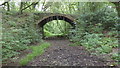
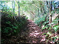
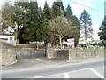
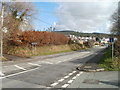
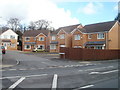
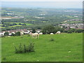
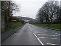
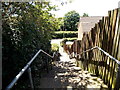
33 photos from this area
Area Information
Key information about the CF72 9PR including its size, population, and administrative classification.
- Area Type
- Postcode
- Area Size
- 8147 m²
- Population
- 1512
- Population Density
- 3230 people/km²
House Prices in CF72 9PR
20
Properties
£124,500
Average Sold Price
£35,000
Lowest Price
£225,000
Highest Price
Showing 20 properties
| Address | Type | Beds | Baths | Last Sale Price | Last Sale Date | |
|---|---|---|---|---|---|---|
| 8 Grove Terrace, Llanharan, CF72 9PR | house | 3 | 1 | £225,000 | Jul 2025 | |
| 15 Grove Terrace, Llanharan, CF72 9PR | Semi-detached | 3 | 1 | £181,500 | Aug 2023 | |
| 20 Grove Terrace, Llanharan, CF72 9PR | Semi-detached | 3 | 2 | £224,000 | Oct 2019 | |
| 17 Grove Terrace, Llanharan, CF72 9PR | house | - | - | £60,000 | Jul 2016 | |
| 9 Grove Terrace, Llanharan, CF72 9PR | Semi-detached | 4 | 2 | £163,000 | Oct 2015 | |
| 6 Grove Terrace, Llanharan, CF72 9PR | house | - | - | £138,000 | Nov 2014 | |
| 12 Grove Terrace, Llanharan, CF72 9PR | Semi-detached | - | - | £95,000 | Nov 2004 | |
| 18 Grove Terrace, Llanharan, CF72 9PR | Semi-detached | - | - | £81,000 | Jul 2004 | |
| 10 Grove Terrace, Llanharan, CF72 9PR | Semi-detached | - | - | £42,500 | Jun 2001 | |
| 14 Grove Terrace, Llanharan, CF72 9PR | Semi-detached | - | - | £35,000 | Apr 1996 |
Page 1 of 2
Energy Efficiency in CF72 9PR
Amenities
Schools
| Rank | School | Type | Entry gender | Ages |
|---|
Explore more schools in this area
Go to Schools tabDemographics
Household Size
Two person
most common
Accommodation Type
Houses
most common
Tenure
61
majority
Ethnic Group
White
most common
Religion
N/A
most common
Household Composition
N/A
most common
Age
47
median
Adults (30-64 years)
most common
Household Deprivation
N/A
with no deprivation
NS-SEC
24
in Lower managerial occupations
Explore more demographic insights in this area
Go to Demographics tabPlanning
Planning Constraints
- Flood RiskPremium
- Ramsar Wetland SitesPremium
- Area of Outstanding Natural BeautyPremium
- Protected Nature ReservePremium
- Protected WoodlandPremium
- Crime RiskPremium