Area Overview for CF72 9JD
Photos of CF72 9JD

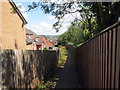
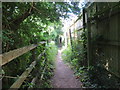
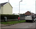
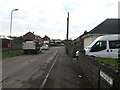
21 photos from this area
Area Information
Key information about the CF72 9JD including its size, population, and administrative classification.
- Area Type
- Postcode
- Area Size
- 1.8 hectares
- Population
- 1429
- Population Density
- 5105 people/km²
House Prices in CF72 9JD
36
Properties
£114,328
Average Sold Price
£45,950
Lowest Price
£260,000
Highest Price
Showing 36 properties
| Address | Type | Beds | Baths | Last Sale Price | Last Sale Date | |
|---|---|---|---|---|---|---|
| 10 Hawthorn Road, Llanharry, CF72 9JD | Semi-detached | 4 | 2 | £260,000 | Sep 2021 | |
| 43 Hawthorn Road, Llanharry, CF72 9JD | Semi-detached | 2 | 1 | £126,500 | Apr 2018 | |
| 5 Hawthorn Road, Llanharry, CF72 9JD | Semi-detached | 3 | 1 | £118,000 | Oct 2016 | |
| 47 Hawthorn Road, Llanharry, CF72 9JD | Terraced | 3 | 1 | £100,000 | Dec 2015 | |
| 45 Hawthorn Road, Llanharry, CF72 9JD | Terraced | 2 | 1 | £117,500 | Jul 2015 | |
| 18 Hawthorn Road, Llanharry, CF72 9JD | Semi-detached | - | - | £135,000 | Sep 2014 | |
| 35 Hawthorn Road, Llanharry, CF72 9JD | house | - | - | £70,000 | Oct 2013 | |
| 23 Hawthorn Road, Llanharry, CF72 9JD | Terraced | - | - | £56,000 | Jan 2003 | |
| 21 Hawthorn Road, Llanharry, CF72 9JD | house | - | - | £45,950 | Apr 2001 | |
| 8 Hawthorn Road, Llanharry, CF72 9JD | Terraced | 3 | 1 | - | - |
Page 1 of 4
Energy Efficiency in CF72 9JD
Amenities
Schools
| Rank | School | Type | Entry gender | Ages |
|---|
Explore more schools in this area
Go to Schools tabDemographics
Household Size
Family (3-5 people)
most common
Accommodation Type
Houses
most common
Tenure
47
majority
Ethnic Group
White
most common
Religion
N/A
most common
Household Composition
N/A
most common
Age
47
median
Adults (30-64 years)
most common
Household Deprivation
N/A
with no deprivation
NS-SEC
19
in Lower managerial occupations
Explore more demographic insights in this area
Go to Demographics tabPlanning
Planning Constraints
- Flood RiskPremium
- Ramsar Wetland SitesPremium
- Area of Outstanding Natural BeautyPremium
- Protected Nature ReservePremium
- Protected WoodlandPremium
- Crime RiskPremium