Area Overview for CF72 9FP
Photos of CF72 9FP
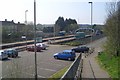
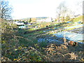
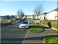
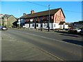
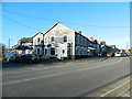

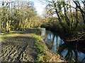
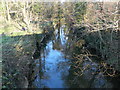
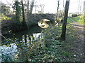


100 photos from this area
Area Information
Key information about the CF72 9FP including its size, population, and administrative classification.
- Area Type
- Postcode
- Area Size
- 6.4 hectares
- Population
- 1493
- Population Density
- 254 people/km²
House Prices in CF72 9FP
41
Properties
£173,678
Average Sold Price
£70,000
Lowest Price
£249,950
Highest Price
Showing 41 properties
| Address | Type | Beds | Baths | Last Sale Price | Last Sale Date | |
|---|---|---|---|---|---|---|
| 36 Meadow View, Tyla Garw, Pontyclun, CF72 9FP | Flat | - | - | £136,000 | Feb 2025 | |
| 30 Meadow View, Tyla Garw, Pontyclun, CF72 9FP | Flat | 2 | - | £155,500 | Mar 2023 | |
| 33 Meadow View, Tyla Garw, Pontyclun, CF72 9FP | Flat | - | - | £113,000 | Feb 2022 | |
| 15 Meadow View, Tyla Garw, Pontyclun, CF72 9FP | Terraced | 4 | 3 | £225,000 | Jun 2021 | |
| 14 Meadow View, Tyla Garw, Pontyclun, CF72 9FP | Semi-detached | 3 | 2 | £210,000 | May 2021 | |
| 32 Meadow View, Tyla Garw, Pontyclun, CF72 9FP | Flat | - | - | £119,995 | Feb 2021 | |
| 27 Meadow View, Tyla Garw, Pontyclun, CF72 9FP | Semi-detached | 4 | 2 | £235,000 | Mar 2020 | |
| 34 Meadow View, Tyla Garw, Pontyclun, CF72 9FP | Flat | - | - | £85,000 | Mar 2020 | |
| 39 Meadow View, Tyla Garw, Pontyclun, CF72 9FP | Flat | 1 | 1 | £94,000 | Dec 2018 | |
| 13 Meadow View, Tyla Garw, Pontyclun, CF72 9FP | house | - | - | £206,000 | Nov 2018 |
Page 1 of 5
Energy Efficiency in CF72 9FP
Amenities
Schools
| Rank | School | Type | Entry gender | Ages |
|---|
Explore more schools in this area
Go to Schools tabDemographics
Household Size
Two person
most common
Accommodation Type
Houses
most common
Tenure
79
majority
Ethnic Group
White
most common
Religion
N/A
most common
Household Composition
N/A
most common
Age
47
median
Adults (30-64 years)
most common
Household Deprivation
N/A
with no deprivation
NS-SEC
45
in Lower managerial occupations
Explore more demographic insights in this area
Go to Demographics tabPlanning
Planning Constraints
- Flood RiskPremium
- Ramsar Wetland SitesPremium
- Area of Outstanding Natural BeautyPremium
- Protected Nature ReservePremium
- Protected WoodlandPremium
- Crime RiskPremium