Area Overview for CF72 4AX
Photos of CF72 4AX
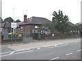

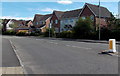
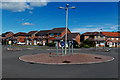
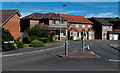
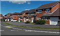


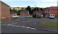

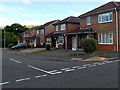
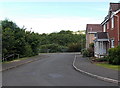
61 photos from this area
Area Information
Key information about the CF72 4AX including its size, population, and administrative classification.
- Area Type
- Postcode
- Area Size
- 2.1 hectares
- Population
- 1736
- Population Density
- 853 people/km²
House Prices in CF72 4AX
44
Properties
£279,526
Average Sold Price
£197,000
Lowest Price
£379,995
Highest Price
Showing 44 properties
| Address | Type | Beds | Baths | Last Sale Price | Last Sale Date | |
|---|---|---|---|---|---|---|
| 29 Heol Y Gylfinir, Llanilid, Pontyclun, CF72 4AX | Detached | 3 | 2 | £313,000 | Oct 2025 | |
| 87 Heol Y Gylfinir, Llanilid, Pontyclun, CF72 4AX | house | - | - | £254,995 | Mar 2025 | |
| 85 Heol Y Gylfinir, Llanilid, Pontyclun, CF72 4AX | house | - | - | £299,995 | Dec 2024 | |
| 19 Heol Y Gylfinir, Llanilid, Pontyclun, CF72 4AX | house | - | - | £310,000 | Sep 2024 | |
| 7 Heol Y Gylfinir, Llanilid, Pontyclun, CF72 4AX | Semi-detached | 4 | 2 | £240,000 | Jul 2024 | |
| 51 Heol Y Gylfinir, Llanilid, Pontyclun, CF72 4AX | house | - | - | £324,995 | May 2023 | |
| 59 Heol Y Gylfinir, Llanilid, Pontyclun, CF72 4AX | house | - | - | £242,995 | Apr 2023 | |
| 71 Heol Y Gylfinir, Llanilid, Pontyclun, CF72 4AX | house | - | - | £379,995 | Apr 2023 | |
| 55 Heol Y Gylfinir, Llanilid, Pontyclun, CF72 4AX | Detached | 3 | 2 | £299,995 | Apr 2023 | |
| 63 Heol Y Gylfinir, Llanilid, Pontyclun, CF72 4AX | Detached | 3 | 2 | £299,995 | Apr 2023 |
Page 1 of 5
Energy Efficiency in CF72 4AX
Amenities
Schools
| Rank | School | Type | Entry gender | Ages |
|---|
Explore more schools in this area
Go to Schools tabDemographics
Household Size
Family (3-5 people)
most common
Accommodation Type
Houses
most common
Tenure
79
majority
Ethnic Group
White
most common
Religion
N/A
most common
Household Composition
N/A
most common
Age
47
median
Adults (30-64 years)
most common
Household Deprivation
N/A
with no deprivation
NS-SEC
46
in Lower managerial occupations
Explore more demographic insights in this area
Go to Demographics tabPlanning
Planning Constraints
- Flood RiskPremium
- Ramsar Wetland SitesPremium
- Area of Outstanding Natural BeautyPremium
- Protected Nature ReservePremium
- Protected WoodlandPremium
- Crime RiskPremium