Area Overview for CF45 3ST
Photos of CF45 3ST
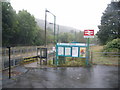

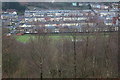
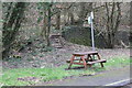


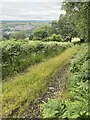
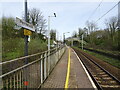

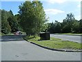
58 photos from this area
Area Information
Key information about the CF45 3ST including its size, population, and administrative classification.
- Area Type
- Postcode
- Area Size
- 9516 m²
- Population
- 1456
- Population Density
- 2215 people/km²
House Prices in CF45 3ST
32
Properties
£76,139
Average Sold Price
£11,000
Lowest Price
£254,995
Highest Price
Showing 32 properties
| Address | Type | Beds | Baths | Last Sale Price | Last Sale Date | |
|---|---|---|---|---|---|---|
| 3 Railway Terrace, Penrhiwceiber, Mountain Ash, CF45 3ST | Terraced | - | - | £50,000 | Nov 2021 | |
| 25 Railway Terrace, Penrhiwceiber, Mountain Ash, CF45 3ST | Terraced | 3 | 1 | £65,000 | Jul 2021 | |
| 29 Railway Terrace, Penrhiwceiber, Mountain Ash, CF45 3ST | Semi-detached | 4 | 3 | £254,995 | Apr 2019 | |
| 16 Railway Terrace, Penrhiwceiber, Mountain Ash, CF45 3ST | Terraced | 3 | 1 | £73,500 | Nov 2018 | |
| 18 Railway Terrace, Penrhiwceiber, Mountain Ash, CF45 3ST | house | - | - | £76,500 | Oct 2017 | |
| 28 Railway Terrace, Penrhiwceiber, Mountain Ash, CF45 3ST | house | 4 | - | £155,000 | Sep 2012 | |
| 6 Railway Terrace, Penrhiwceiber, Mountain Ash, CF45 3ST | Terraced | - | - | £83,000 | Jul 2008 | |
| 1 Railway Terrace, Penrhiwceiber, Mountain Ash, CF45 3ST | Terraced | 3 | 1 | £59,995 | Jul 2006 | |
| 24 Railway Terrace, Penrhiwceiber, Mountain Ash, CF45 3ST | Terraced | - | - | £62,000 | Jul 2005 | |
| 22 Railway Terrace, Penrhiwceiber, Mountain Ash, CF45 3ST | Terraced | - | - | £41,950 | Jun 2002 |
Page 1 of 4
Energy Efficiency in CF45 3ST
Amenities
Schools
| Rank | School | Type | Entry gender | Ages |
|---|
Explore more schools in this area
Go to Schools tabDemographics
Household Size
Two person
most common
Accommodation Type
Houses
most common
Tenure
65
majority
Ethnic Group
White
most common
Religion
N/A
most common
Household Composition
N/A
most common
Age
47
median
Adults (30-64 years)
most common
Household Deprivation
N/A
with no deprivation
NS-SEC
15
in Lower managerial occupations
Explore more demographic insights in this area
Go to Demographics tabPlanning
Planning Constraints
- Flood RiskPremium
- Ramsar Wetland SitesPremium
- Area of Outstanding Natural BeautyPremium
- Protected Nature ReservePremium
- Protected WoodlandPremium
- Crime RiskPremium