Area Overview for CF44 8EQ
Photos of CF44 8EQ


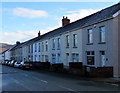
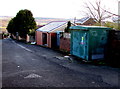

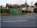

100 photos from this area
Area Information
Key information about the CF44 8EQ including its size, population, and administrative classification.
- Area Type
- Postcode
- Area Size
- 5.1 hectares
- Population
- 1813
- Population Density
- 2346 people/km²
House Prices in CF44 8EQ
62
Properties
£206,890
Average Sold Price
£115,000
Lowest Price
£315,000
Highest Price
Showing 62 properties
| Address | Type | Beds | Baths | Last Sale Price | Last Sale Date | |
|---|---|---|---|---|---|---|
| 106 Y Dolydd, Cwmdare, Aberdare, CF44 8EQ | Detached | 4 | 3 | £115,000 | Sep 2025 | |
| 118 Y Dolydd, Cwmdare, Aberdare, CF44 8EQ | Semi-detached | 4 | 3 | £253,000 | May 2025 | |
| 92 Y Dolydd, Cwmdare, Aberdare, CF44 8EQ | Detached | 3 | 3 | £285,000 | Jun 2024 | |
| 84 Y Dolydd, Cwmdare, Aberdare, CF44 8EQ | house | - | - | £220,000 | Oct 2023 | |
| 78 Y Dolydd, Cwmdare, Aberdare, CF44 8EQ | house | - | - | £315,000 | Oct 2021 | |
| 116 Y Dolydd, Cwmdare, Aberdare, CF44 8EQ | house | 3 | 3 | £185,000 | Oct 2019 | |
| 120 Y Dolydd, Cwmdare, Aberdare, CF44 8EQ | Semi-detached | 4 | 1 | £179,995 | Sep 2019 | |
| 122 Y Dolydd, Cwmdare, Aberdare, CF44 8EQ | house | - | - | £222,500 | Aug 2019 | |
| 124 Y Dolydd, Cwmdare, Aberdare, CF44 8EQ | house | - | - | £185,000 | Aug 2019 | |
| 114 Y Dolydd, Cwmdare, Aberdare, CF44 8EQ | house | - | - | £269,995 | Jul 2019 |
Page 1 of 7
Energy Efficiency in CF44 8EQ
Amenities
Schools
| Rank | School | Type | Entry gender | Ages |
|---|
Explore more schools in this area
Go to Schools tabDemographics
Household Size
Two person
most common
Accommodation Type
Houses
most common
Tenure
84
majority
Ethnic Group
White
most common
Religion
N/A
most common
Household Composition
N/A
most common
Age
47
median
Adults (30-64 years)
most common
Household Deprivation
N/A
with no deprivation
NS-SEC
36
in Lower managerial occupations
Explore more demographic insights in this area
Go to Demographics tabPlanning
Planning Constraints
- Flood RiskPremium
- Ramsar Wetland SitesPremium
- Area of Outstanding Natural BeautyPremium
- Protected Nature ReservePremium
- Protected WoodlandPremium
- Crime RiskPremium