Area Overview for CF44 0YQ
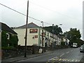
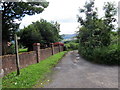
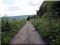
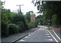
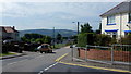
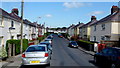
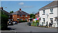
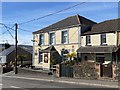
Photos of CF44 0YQ
Area Information
CF44 0YQ is a small residential postcode in Rhondda Cynon Taf, Wales, encompassing the village of Llwydcoed. With a population of 1,933 and a density of 217 people per square kilometre, it reflects a compact, closely knit community. Historically shaped by the Aberdare Ironworks, established in 1800–1801, the area evolved from an agricultural landscape into an industrial hub. Today, its character blends heritage with modern living, offering a quiet alternative to nearby towns. Residents benefit from proximity to Aberdare, a town with retail and transport links, while retaining the village’s sense of local identity. The area’s appeal lies in its manageable size, with homes predominantly owner-occupied and a median age of 47 suggesting a stable, mature population. Daily life here is defined by accessible amenities, including nearby rail services and a mix of retail outlets, balanced with the tranquillity of a small village. For those seeking a low-maintenance lifestyle with historical roots, CF44 0YQ presents a distinct blend of practicality and tradition.
- Area Type
- Postcode
- Area Size
- Not available
- Population
- 1933
- Population Density
- 217 people/km²
The property market in CF44 0YQ is characterised by high home ownership, with 80% of residents living in their own homes. This suggests a strong preference for owner-occupation over renting, which is typical in smaller, established communities. The accommodation type is predominantly houses, reflecting a market that prioritises family-friendly, single-dwelling properties. Given the area’s small size and limited housing stock, the market is likely to be stable with minimal new developments. Buyers should expect a focus on existing homes rather than speculative investment, as the area does not appear to cater to rental demand. The concentration of houses also implies that properties may be larger or more spread out than in densely populated urban areas. For those seeking a home in CF44 0YQ, the market offers a chance to purchase in a low-turnover environment with a clear emphasis on long-term residency.
House Prices in CF44 0YQ
No properties found in this postcode.
Energy Efficiency in CF44 0YQ
The lifestyle in CF44 0YQ is supported by a range of nearby amenities, including five retail outlets such as Spar, Tesco Aberdare, and Farmfoods Aberdare. These shops provide access to everyday essentials, reducing the need for long trips to larger centres. The presence of multiple railway stations, including Aberdare and Merthyr Tydfil, enhances mobility, allowing residents to reach workplaces, leisure destinations, or social hubs easily. While the area does not list parks or leisure facilities explicitly, its proximity to Aberdare suggests access to broader recreational options. The combination of retail convenience and transport links creates a practical, community-oriented lifestyle. For those valuing accessibility without urban congestion, CF44 0YQ offers a balance of local amenities and regional connectivity.
Amenities
Schools
The nearest school to CF44 0YQ is Llwydcoed Primary, which falls under the ‘other’ category in the data. No Ofsted rating is provided, but the presence of a primary school indicates that families with young children have access to local education. The absence of secondary schools or other educational institutions within the area means that students may need to travel to nearby towns such as Aberdare for higher education. This suggests a reliance on regional schools rather than a comprehensive local network. For families prioritising proximity to schools, the availability of a primary institution is a positive, though secondary education options may require planning for commuting. The single school listed highlights the need to consider broader educational infrastructure when evaluating the area’s suitability for families.
| Rank | School | Type | Entry gender | Ages |
|---|
Explore more schools in this area
Go to Schools tabDemographics
The community in CF44 0YQ is predominantly composed of adults aged 30–64, with a median age of 47. This suggests a mature population, likely with established careers and families. Home ownership is high at 80%, indicating a stable housing market where most residents live in their own homes. The accommodation type is primarily houses, reflecting a preference for single-family dwellings over flats. The predominant ethnic group is White, aligning with broader demographic patterns in the region. While no specific deprivation data is provided, the high home ownership rate and age profile suggest a community with relatively stable economic conditions. The population density of 217 people per square kilometre implies a balance between residential space and communal facilities, supporting a cohesive, neighbourly environment. For prospective buyers, this demographic profile indicates a low turnover of properties and a focus on long-term residency.
Household Size
Accommodation Type
Tenure
Ethnic Group
Religion
Household Composition
Age
Household Deprivation
NS-SEC
Explore more demographic insights in this area
Go to Demographics tabPlanning
Planning Constraints
- Flood RiskPremium
- Ramsar Wetland SitesPremium
- Area of Outstanding Natural BeautyPremium
- Protected Nature ReservePremium
- Protected WoodlandPremium
- Crime RiskPremium