Area Overview for CF44 0YA
Photos of CF44 0YA
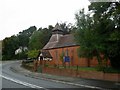
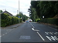
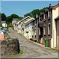
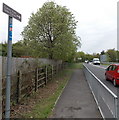
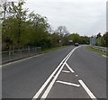
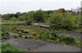
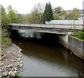
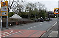
45 photos from this area
Area Information
Key information about the CF44 0YA including its size, population, and administrative classification.
- Area Type
- Postcode
- Area Size
- 9.1 hectares
- Population
- 1933
- Population Density
- 217 people/km²
House Prices in CF44 0YA
27
Properties
£157,535
Average Sold Price
£47,500
Lowest Price
£319,950
Highest Price
Showing 27 properties
| Address | Type | Beds | Baths | Last Sale Price | Last Sale Date | |
|---|---|---|---|---|---|---|
| 3 Corner House Street, Llwydcoed, Aberdare, CF44 0YA | Terraced | 2 | 1 | £119,000 | May 2024 | |
| 30 Corner House Street, Llwydcoed, Aberdare, CF44 0YA | Terraced | - | - | £77,000 | May 2018 | |
| Copper Beeches, Corner House Street, Llwydcoed, Aberdare, CF44 0YA | Detached | 5 | 4 | £319,950 | Dec 2016 | |
| The Willows, Corner House Street, Llwydcoed, Aberdare, CF44 0YA | Detached | - | - | £309,950 | Sep 2016 | |
| Tir Coed, Corner House Street, Llwydcoed, Aberdare, CF44 0YA | Bungalow | - | - | £250,000 | Aug 2013 | |
| 33 Corner House Street, Llwydcoed, Aberdare, CF44 0YA | Bungalow | - | - | £110,000 | Mar 2013 | |
| Rustlings, 0 Corner House Street, Aberdare, CF44 0YA | Detached | 4 | 2 | £172,000 | Aug 2012 | |
| 15 Corner House Street, Llwydcoed, Aberdare, CF44 0YA | house | - | - | £80,000 | Nov 2008 | |
| 29 Corner House Street, Llwydcoed, Aberdare, CF44 0YA | house | - | - | £89,950 | Nov 2005 | |
| 1 Corner House Street, Llwydcoed, Aberdare, CF44 0YA | Terraced | - | - | £47,500 | Dec 1997 |
Page 1 of 3
Energy Efficiency in CF44 0YA
Amenities
Schools
| Rank | School | Type | Entry gender | Ages |
|---|
Explore more schools in this area
Go to Schools tabDemographics
Household Size
Two person
most common
Accommodation Type
Houses
most common
Tenure
80
majority
Ethnic Group
White
most common
Religion
N/A
most common
Household Composition
N/A
most common
Age
47
median
Adults (30-64 years)
most common
Household Deprivation
N/A
with no deprivation
NS-SEC
36
in Lower managerial occupations
Explore more demographic insights in this area
Go to Demographics tabPlanning
Planning Constraints
- Flood RiskPremium
- Ramsar Wetland SitesPremium
- Area of Outstanding Natural BeautyPremium
- Protected Nature ReservePremium
- Protected WoodlandPremium
- Crime RiskPremium